Length: .7 mi (1.13 km)
Elevation Gain: 259 ft (78.94 m)
Route Type: Out and Back
Difficulty: Moderate
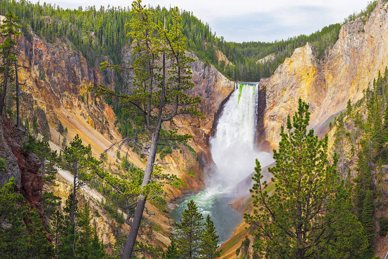
Red Rock Point, in Yellowstone National Park, provides a stunning photography opportunity of the Lower Falls. This waterfall is the crowning jewel of what is known as the “Grand Canyon of the Yellowstone.” According the the National Park Service, “The Grand Canyon of the Yellowstone River expresses the park’s complex geologic history in dramatic colors and shapes. The Upper and Lower Falls of the Yellowstone River add to the grandeur of the unique natural treasure.” (NPS) Red Rock Point, while a bit difficult to traverse, allows you an up close and personal view of the Lower Falls.
Accessing Lower Falls at Red Rock Point in Yellowstone National Park
Starting Location: Lookout Point Parking Lot, Yellowstone National Park, WY
GPS (DD): 44.72155, -110.48778
In order to access Red Rock Point in Yellowstone National Park, you will need to take the Grand Loop Road. This road is the main road that loops around the entirety of Yellowstone National Park. From here, you will turn left onto North Rim Drive. This one-way loop road parallels the north rim of the Grand Canyon of Yellowstone.
The entrance to North Rim Drive from Grand Loop Road can be found at GPS (DD): 44.72059, -110.49966. The Lookout Point parking lot is on the North Rim Drive at GPS (DD): 44.72155, -110.48778. There is an entrance fee for Yellowstone National Park, but no permit is required to visit Lookout Point or Red Rock Point on the North Rim of the Grand Canyon of the Yellowstone River. (hikespeak)
From the Lookout Point parking area, you will descend a short set of stairs to a paved trail heading toward the Lookout Point overlook. Just before you start a slight ascent up towards Lookout Point, a trail breaks off to the right and starts the rapid and steep 500 ft (152.4 m) descent down to Red Rock Point. Be prepared for steep grades and rough rocky surfaces, which can be tough on your knees. I recommend good walking or hiking shoes with good tread and a walking stick. Also be prepared for a steep uphill return.
Weather, Closures, and Hiking Tips for Red Rock Point
Yellowstone Park’s interior roads are generally open from mid May until the end of October, depending on weather conditions. You should always check the park website before planning your trip.
The hiking trail can be muddy, especially early in the season. Depending on the season and/or recent rains it could tend to a bit slick. The upper half of the road is dirt with many rocks to step over. It can be quite steep. A good walking stick would be advised. The lower half of the trail consists of a boardwalk and wooden stairs which can be slick when wet.
The platform at the bottom is fairly small. There are few benches to sit on. There will usually be numerous people lined up for “selfies” along with photographers. Expect to have to wait your turn to take your photo. Red Rock Point is the closest point relative to the base of the falls you can reach and offers a stunning view of the 308 ft (93.89 m) Lower Falls tier of Yellowstone Falls.
Photography Tips at Red Rock Point
Most photographers will want to have their wider angle 14-24mm lens for this location. For the Golden Hour shot, you will have to contend with deep shadows in the 1,000 ft (304.8 m) deep canyon. Waiting until later in the morning when the sun has risen some provides light in the canyon. Depending upon the time of year will dictate when best to time your shot.
I shot the above photograph at about 10 am with some overcast clouds which cut the harsh glare normally experienced at this time of day. For my photo featured on this page, I used a Canon R5 camera and 300mm lens. My settings were f/13, 1/160th sec. and ISO 400. The original image consists of 3,878 individual focus bracketed images. These were processed down to 253 focus stacked images and then stitched into the 2.86 Gigapixel, 154″ x 207″ 300 dpi final wall mural image.
Find Your Favorite Location
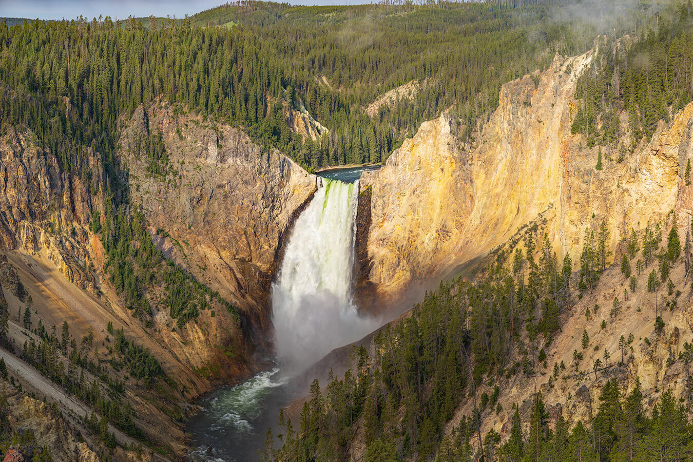
For the fainter of heart that isn’t physically able to make the 500 ft (152.4 m) decent into the canyon, the far less challenging Lookout Point is a short .15 mi (.24 km) round trip with only 25 ft (7.62 m) of elevation change. While not quite as nice of a composition, Lookout Point still offers a spectacular view of the Lower Falls as shown in the photo below.

No matter which location you visit, you will love Lower Falls. Before making your trip, consider checking the official Yellowstone National Park website or contacting the park’s visitor center for the most up-to-date information on trail conditions, accessibility, and any recent changes. As with any visit to a national park, it’s important to follow park regulations, practice “Leave No Trace” principles, and prioritize safety while exploring this beautiful area. Enjoy your time exploring the natural wonders of the Lower Falls at Red Rock Point!
Happy Travels!
John Freeman, Featured National Park Photographer
Want to learn more about Yellowstone National Park? Check out these maps, guides & books:
- Yellowstone National Park Map (National Geographic Trails Illustrated Map)
- Frommer’s Yellowstone and Grand Teton National Parks (Complete Guide)
- Yellowstone National Park: The First 150 Years
- Lonely Planet Yellowstone & Grand Teton National Parks 6 (National Parks Guide)
- Best Easy Day Hikes Yellowstone National Park (Best Easy Day Hikes Series)
- Yellowstone Treasures: The Traveler’s Companion to the National Park
- Yellowstone National Park (Images of America: Wyoming)
- A Weird and Wild Beauty: The Story of Yellowstone, the World’s First National Park
Please note, by making purchases through our affiliate links, you are supporting our mission to celebrate and showcase our National Parks and the photographers who frequent them. As an Amazon Associate, National Park Photographer earns from qualifying purchases at not cost to you. We appreciate your support.

