The National Park of American Samoa is one of the newer National Parks having been established in 1988. The Samoan culture is the oldest in Polynesia and the meaning of Samoa is “sacred earth.” The National Park of American Samoa is 9,103 total acres (6,303 land acres and 2,800 marine acres—mostly coral reefs) spanning three islands. In 1993, the Samoan chiefs agreed to sign a lease with the National Park Service giving them the right to manage the land for 50 years. Remote and exotic, this National Park receives about 14,000 visitors annually. Be sure to visit the park website for current closures and conditions.
Top Photography Locations and Sights at the National Park of American Samoa:
As photographers, we know that many of you will only have one chance in a lifetime to visit the National Parks. To make your life easier, we have compiled a list of our top photography locations and sights at National Park of American Samoa! While this is not comprehensive, and there are many more amazing sights to see, it should give you a good feel for the park.
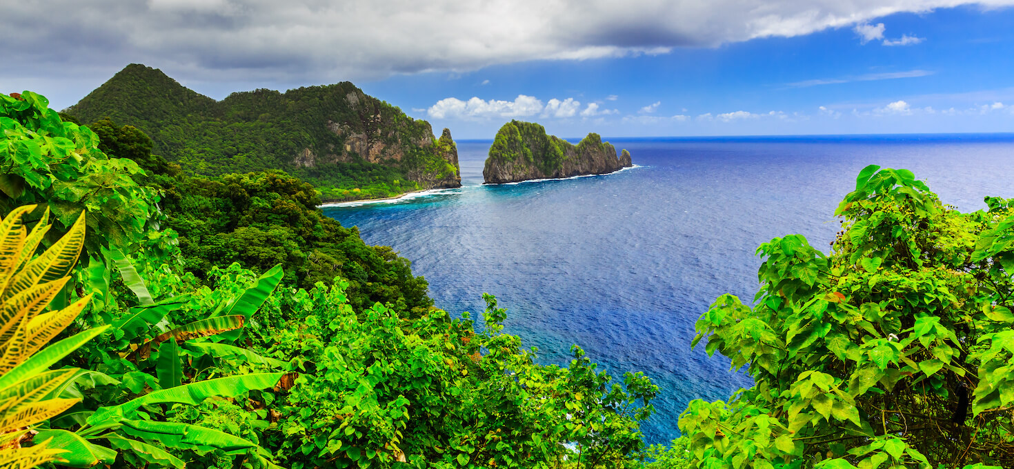
Ofu Island (Manu’a Islands)
A remote paradise, offering pristine beaches, lush rainforests, and vibrant coral reefs for visitors to explore.
Ta’ū Island (Manu’a Islands)
Taʻū is the largest inhabited island in the Manu’a Islands and the easternmost volcanic island of the Samoan Islands. It is part of American Samoa. (Wikipedia)
Tutuila Island
A tropical gem, featuring stunning coastline, dense jungles, and cultural sites that showcase the island’s rich Polynesian heritage.
National Park of American Samoa Wildlife Photography:
National Park of American Samoa is filled with wildlife and biodiversity. If you like wildlife photography, you will love what this park has to offer!
Want to learn more about National Park of American Samoa? Check out these maps, guides & books:
- Explore American Samoa: The Complete Guide to Tutuila, Aunu’u, and Manu’a Islands
- Samoa National Park Map & Illustrated Trails: Guide to Hiking and Exploring Samoa National Park
- Fodor’s The Complete Guide to the National Parks of the USA: All 63 parks from Maine to American Samoa (Full-color Travel Guide)
- National Park of American Samoa Map – Vivid Imagery Laminated Poster Print – 20 Inch by 30 Inch Laminated Poster With Bright Colors
- Teddy’s Walkabout: American Samoa National Park
Please note, by making purchases through our affiliate links, you are supporting our mission to celebrate and showcase our National Parks and the photographers who frequent them. As an Amazon Associate, National Park Photographer earns from qualifying purchases at no cost to you. We appreciate your support.
Featured National Park Photographers:
- Adobe / SCStock: Pago Pago
- NPS: Birdwatching, Snorkeling, Si’u Point Trail, Stargazing, Blunts Point Trail, Pola Island Trail, Tuafaunua Trail
- Shutterstock / BlueBarronPhoto: Black Emo Skink on the Island of Tutuila, Eastern Wattled-honeyeater on the Island of Tutuila, Hermit Crab on the Island of Tutuila, Samoan Fruit Bat, Samoan Myzomela Perched on a Wire, Short Samoan Tree Snail
- Shutterstock / Bryan Chernick: Traditional Samoan Villages
- Shutterstock / Danita Delimont: Mount ‘Alava, Wildflowers
- Brenda Smith DVM: Rainmaker Mountain
- Shutterstock / lego 19861111: Fagatele Bay
- Shutterstock / Lloyd Wallin Photography: Vatia Bay
- Shutterstock / Peto Laszlo: Pago Pago Harbor
Want to visit more parks? Check out our complete list of the US National Parks!
Do you want to be featured on National Park Photographer?
Why wait! Contact us today at nationalparkphoto@gmail.com for more information about being featured!