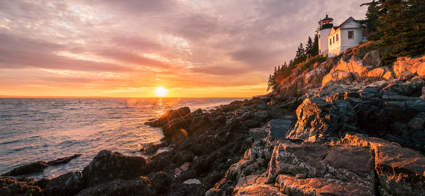
Acadia National Park in Maine offers a captivating blend of rugged mountains, breathtaking coastlines, and rich cultural history. With its highest peak, Cadillac Mountain, and a network of scenic trails, visitors can explore diverse landscapes and enjoy panoramic views of the Atlantic Ocean. The park’s rocky shores, sandy beaches, and iconic landmarks like Thunder Hole and Bass Harbor Head Lighthouse provide picturesque settings. Abundant wildlife and historic carriage roads add to the park’s charm. Acadia National Park is a place where nature’s beauty and cultural heritage converge, inviting visitors to experience its unique wonders. For current road conditions and closures, be sure to visit the park website.
Map of Acadia National Park:
Top Photography Locations and Sights at Acadia National Park:
As photographers, we know that many of you will only have one chance in a lifetime to visit the National Parks. To make your life easier, we have compiled a list of our top photography locations and sights at Acadia National Park! While this is not comprehensive, and there are many more amazing sights to see, it should give you a good feel for the park.
East Side of Mount Desert Island
The eastern side of Mount Desert Island is known for its stunning coastal scenery, rugged granite cliffs, and picturesque harbors. This area is home to the bustling town of Bar Harbor, a popular destination for visitors exploring nearby Acadia National Park.
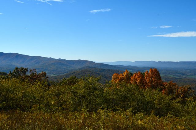
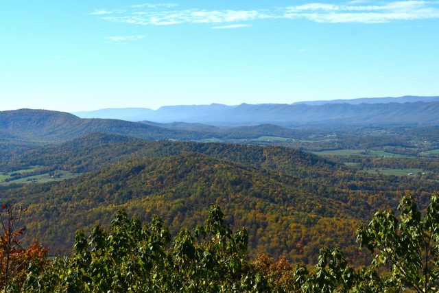
West Side of Mount Desert Island
Often referred to as the “quiet side,” the western half of Mount Desert Island offers a more serene and less crowded experience compared to the bustling East Side. This area features peaceful harbors, such as Southwest Harbor and Bass Harbor, with charming coastal villages and working waterfronts.
Schoodic Peninsula
Located across Frenchman Bay from Mount Desert Island, the Schoodic Peninsula a rugged and less-visited part of Acadia National Park. Known for its dramatic granite headlands and crashing surf, the peninsula offers a more remote and tranquil experience.
Outer Islands
The Acadia Outer Islands are a collection of small, remote islands surrounding Mount Desert Island, each offering unique and pristine landscapes. These islands are less developed and accessible primarily by boat.
Acadia National Park Wildlife Photography:
Acadia National Park is filled with wildlife and biodiversity. If you like wildlife photography, you will love what this park has to offer!
Want to learn more about Acadia National Park? Check out these maps, guides & books:
- Best Easy Day Hiking Guide and Trail Map Bundle: Acadia National Park
- Carriage Roads of Acadia: A Pocket Guide
- Moon Acadia National Park: Seaside Towns, Fall Foliage, Cycling & Paddling (Travel Guide)
- Acadia National Park: The Complete Guide (Color Travel Guide)
- Historic Acadia National Park: The Stories Behind One of America’s Great Treasures
Please note, by making purchases through our affiliate links, you are supporting our mission to celebrate and showcase our National Parks and the photographers who frequent them. As an Amazon Associate, National Park Photographer earns from qualifying purchases at no cost to you. We appreciate your support.
Featured National Park Photographers:
- Abba’s Creations Photography: Raven’s Nest
- NPS: Baker Island, Precipice Trail, Wild Gardens of Acadia, Wood Frog
- NPS / Jane Gamble: Meadow Vole, Red-Breasted Nuthatch, Rough Green Snake
- NPS / Matthew Lambert: Otter Cliff
- NPS / Victoria Stauffenberg: Gorham Mountain Trail, Sand Beach
- NPS / Will Greene: Beech Mountain
- Pixabay: Beehive Mountain Trail, Cadillac Mountain, Carriage Roads, Jordan Pond, Ocean Path, Park Loop Road, Schoodic Peninsula, Snapping Turtle
- Shutterstock / Harry Collins: Barred Owlets, Seal
- Shutterstock / Luc Rousseau: Monument Cove
- Shutterstock / outmeo: Bass Harbor Head Light
- Shutterstock / View_Point: Thunder Hole
Want to visit more parks? Check out our complete list of the US National Parks!
Do you want to be featured on National Park Photographer?
Why wait! Contact us today at nationalparkphoto@gmail.com for a chance to be featured as a National Park Photographer!