Length: .1 mi (.16 km)
Elevation Gain: Minimal
Route Type: Out and Back
Difficulty: Easy
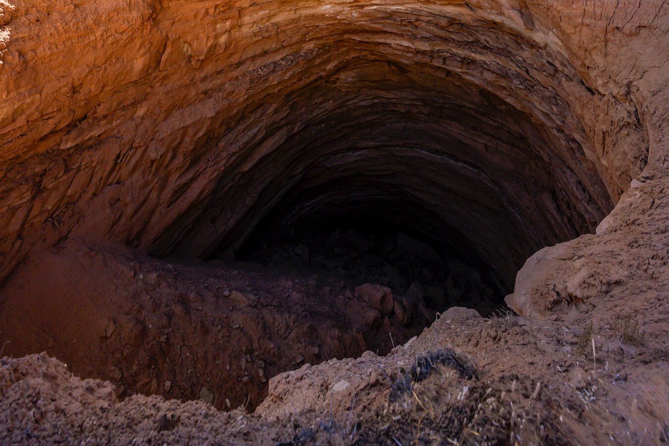
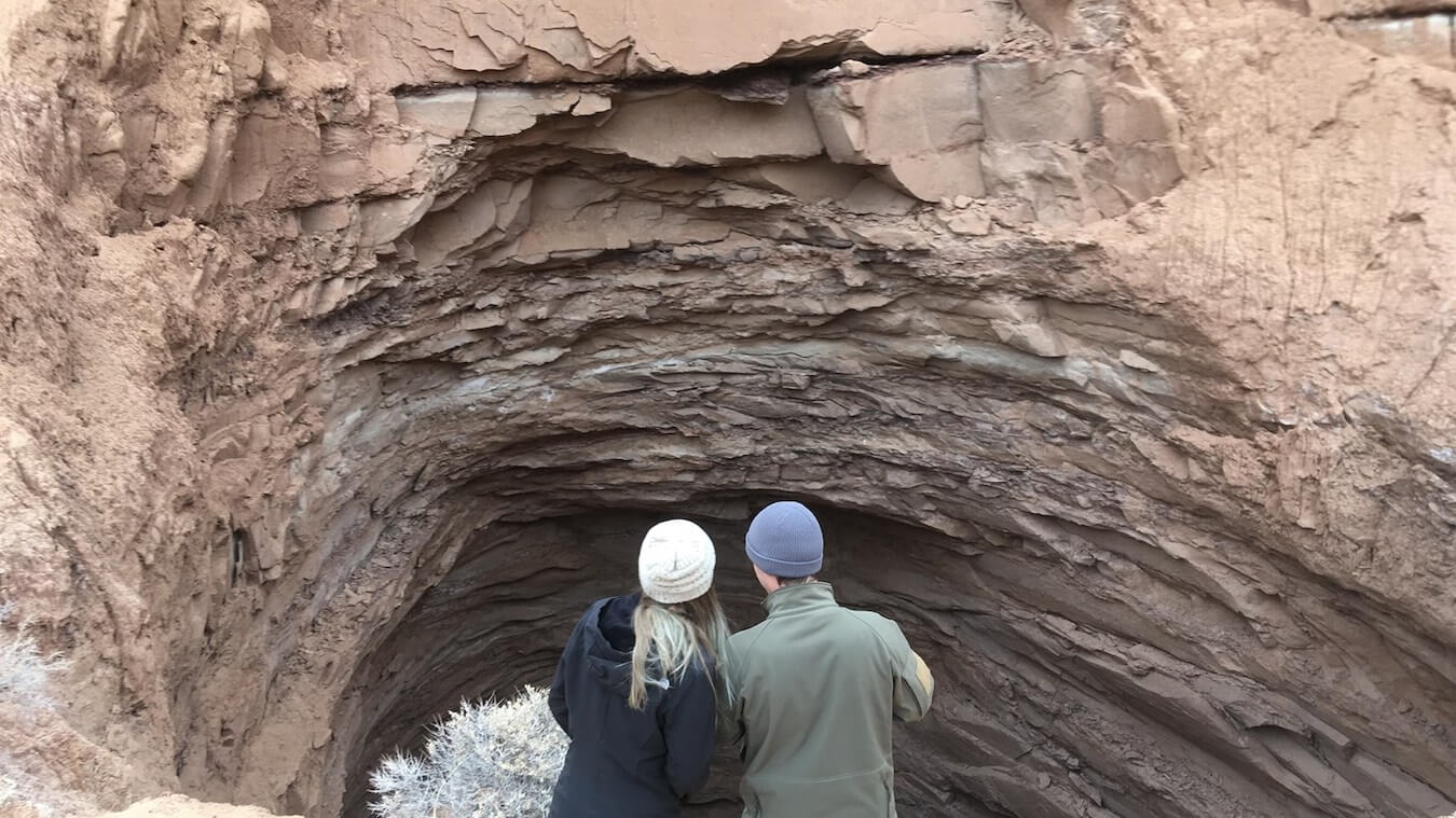
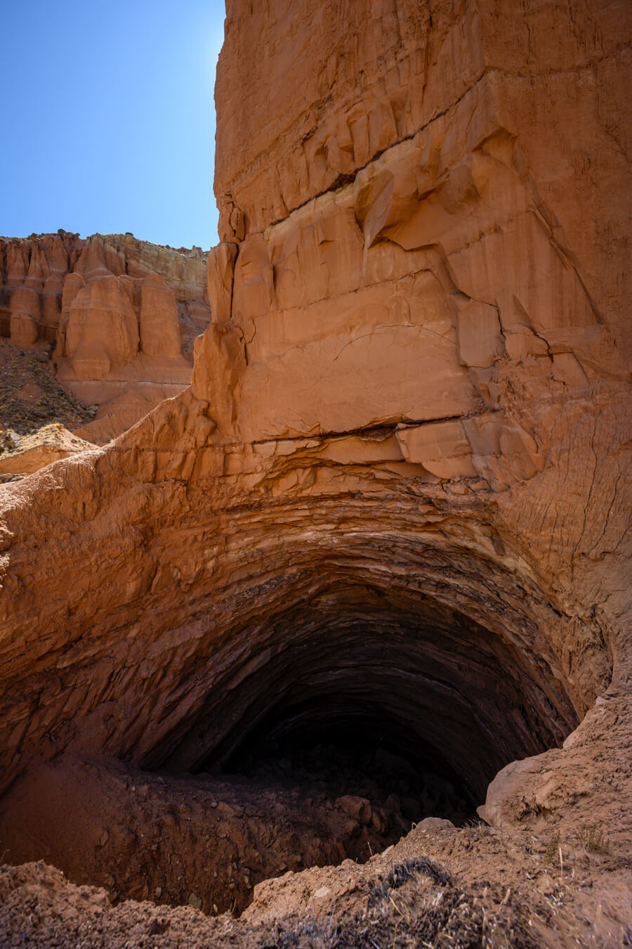
The Gypsum Sinkhole is located in the Cathedral Valley District, also known as the North District, in Capitol Reef National Park. It is one of the stops along the Cathedral Valley Loop Drive. This sinkhole is “50 feet (15 m) in diameter and 200 feet (61 m) deep.” (NPS) As the ground is soft and unstable, it is advised to keep your distance from the edge of the sinkhole as the ground can collapse at any time.
Accessing Gypsum Sinkhole in Cathedral Valley
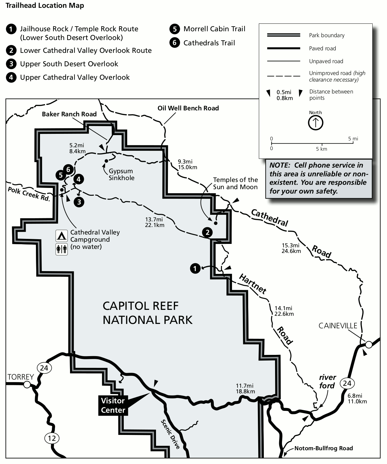
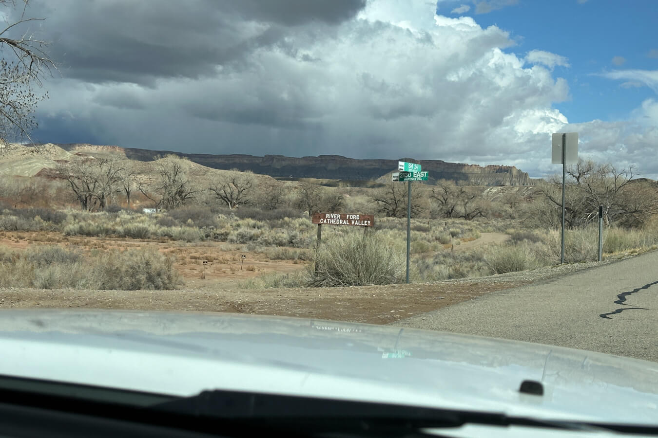
Starting Location: Gypsum Sinkhole Road, Utah
GPS (DD): 38.505806, -111.315712
There are a few different ways to access the Gypsum Sinkhole. All methods will take you to unpaved roads that will have varying conditions depending upon the time of year and current weather. A high-clearance, 2WD/4WD vehicle is recommended. (This does not include ATVs/UTVs, even street ones, which are not allowed in Capitol Reef National Park.) To make your trip easier, there are jeep rentals based in Torrey, UT that I highly recommend.
Be sure to check the current road conditions before venturing out. Some of the roads can become impassable when wet. You can ask at the Visitor Center, check the current conditions at the NPS website, or call 435-425-3791 (press #1 for information and then #4 for current road conditions). This phone number will also give you access to the current weather conditions and the harvest and blossom schedule for the Fruita orchards.
The most popular way to experience Cathedral Valley is by taking the Cathedral Valley Loop drive in a clockwise direction, beginning on Hartnet Road. The entire loop will take you 6-8 hours to drive and explore, so if you choose to go this route, plan accordingly.
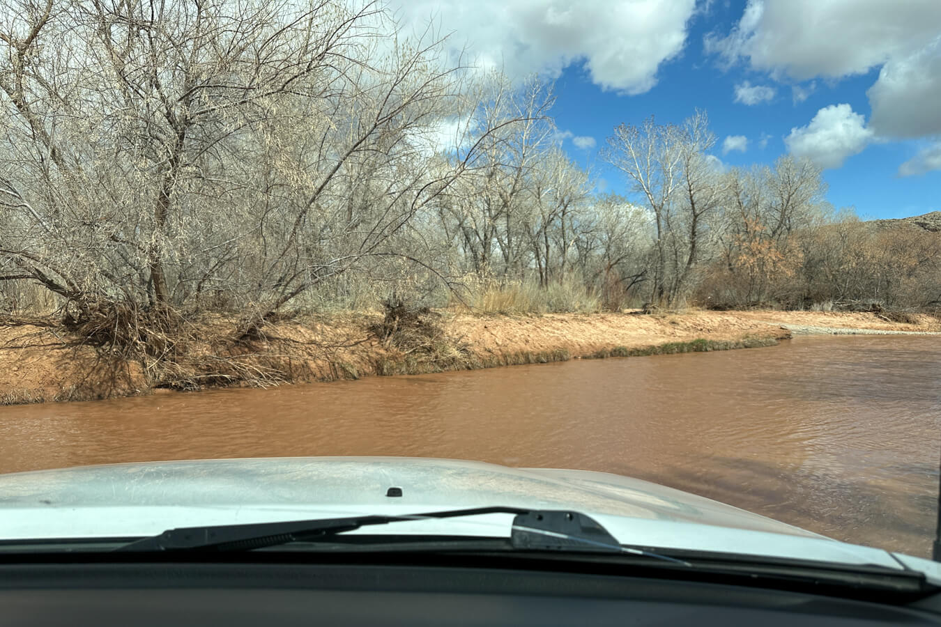
The Hartnet Road entrance requires you to drive a short distance in the Fremont River. You read that right. Not over…in. There is no driving bridge that crosses the Fremont River on this route. (Here is a link to a map for the Hartnet Road River Ford) As the water levels vary, you will want to make sure to check the above references for the current conditions. Once you ford the Fremont River, after about 8.5 mi (13.68 km) you will arrive at the Bentonite Hills. While not technically in Capitol Reef National Park, they are a beautiful location and well worth photographing.
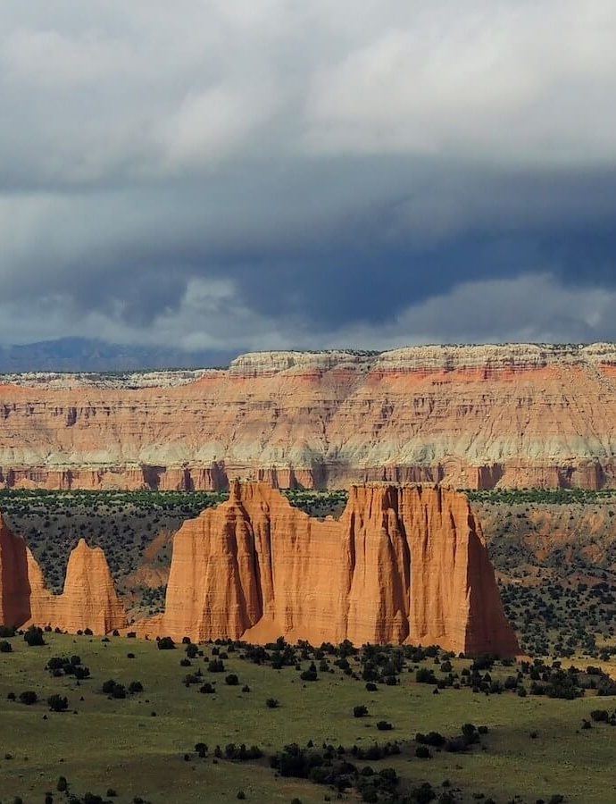
From there, you can continue to drive the loop. You will pass by several overlooks and trailheads, including Jailhouse Rock, Upper Cathedral Valley Overlook, and Morrell Cabin. (This article from Dirt in My Shoes gives a great overview of the entire loop with pictures!)
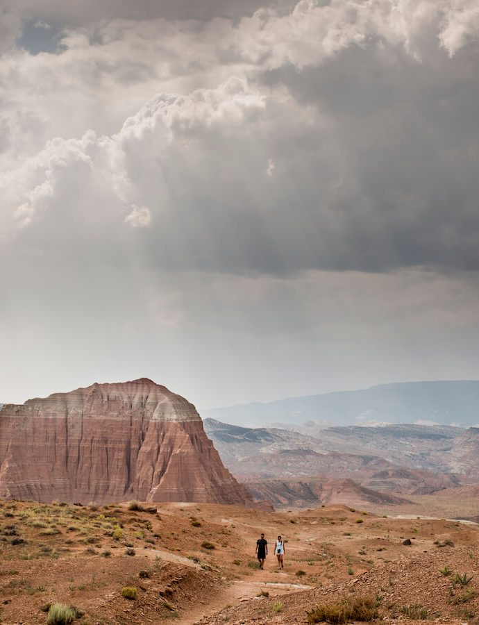
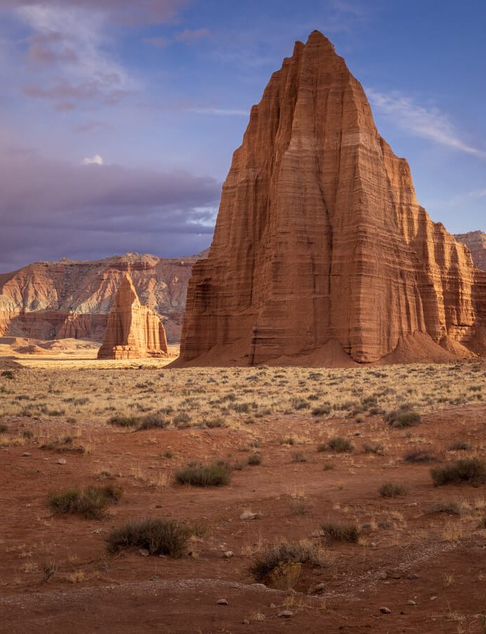
After you pass by the primitive campground, you will see the Gypsum Sinkhole road on your right. There is a small 2-minute hike from the end of the road to the sinkhole. If you continue to do the Cathedral Valley Loop drive, you will pass by Glass Mountain and the Temples of the Sun and Moon and will ultimately reach the main, paved road, UT-24 W. Turn right on UT-24 W if you want to return back to Capitol Reef National Park.
If you don’t have 6-8 hours and just want to see the Gypsum Sinkhole, an alternative route is to drive the 25.8 miles (41.52 km) each way from Caineville up N Cathedral Road. You will definitely want to stop at Glass Mountain and the Temples of the Sun and Moon on your way. The road conditions will still vary on this section of road, and you will still need a high clearance vehicle, but you won’t need to cross the Fremont River and it will cut your travel time down immensely.
You can also access Cathedral Valley from the north via Poll Creek Road, Baker Ranch Road, or Oil Well Bench Road depending upon where your starting location is. Baker Ranch Road will give you the closest access to the Gypsum Sinkhole. (Check the National Park website for complete driving distances from each location.)
Driving and Hiking Tips at the Cathedral Valley
Cathedral Valley is located in a remote part of Capitol Reef National Park. As such, you need to use extreme caution when planning your trip. Here are some tips!
Be Prepared for the Unexpected
Due to its remote location, Cathedral Valley is less visited than the other areas in Capitol Reef National Park. Because of that, you need to be prepared for constantly changing conditions as well as the possibility of becoming stranded. While not always the case, it is possible to come across a muddy or sandy area that will be difficult for you to navigate, especially after spring and summer rains or winter snow. Depending upon the weather, some areas may become impassable. Remember to ask a park ranger at the Capitol Reef Visitor Center, or call the main number, 435-425-3791, for the current conditions. (Press #1 for information, and then #4 for current road conditions. For weather conditions press #3.) (NPS)
Recommended Emergency Supplies in Cathedral Valley
Whenever you are hiking or off-roading, it is always a good idea to bring extra emergency supplies with you as help may not come for several hours to several days. Here is a small list of recommended items to bring when you visit Gypsum Sinkhole:
- Water
- Food
- Gas
- Extra Clothing/Layers
- A Shovel
- Toilet Paper/Wipes and Bags (Remember to leave no trace ;))
- First Aid Kit
- Map
- Additional Emergency Supplies (Click here for a complete list of our recommended photography and hiking gear)
There is no potable water in Cathedral Valley and there are no bathrooms, aside from a pit toilet found at the primitive campsite on the north end of Cathedral Valley. Bring more water than you think you need. If you are not comfortable going to the bathroom outside, you may also want to bring a small pop-up tent and portable toilet with you.
Be Prepared for Limited to no Cell Service
There is limited to no cell phone service in Cathedral Valley. Because of that, it is a good idea to let someone know where you are going as a backup in case something happens. Even a screenshot text to a friend or family member prior to entering the area would work.
It would also be helpful to have some sort of map or GPS-tracking device to help you navigate the trails and roads. Even when you don’t think you will get lost, if the trails or roads are poorly marked, it is a possibility. Some GPS trackers, like the Garmin inReach and the Garmin inReach Mini, can also communicate your location to others. At a minimum, have a printed copy of the maps and hiking trails or download them to your phone.
Best Time of Year to Visit Gypsum Sinkhole in Cathedral Valley
Cathedral Valley is open year-round. Due to extreme heat in the summer and freezing temperatures in the winter, spring and fall are generally considered the best times of year to visit and photograph Gypsum Sinkhole. The roads are generally regraded in Cathedral Valley just after the snow melts in the early spring. Going at this time of year will allow for the smoothest possible driving conditions. Our tour guide, Hunter, told us that the roads were optimal for driving when we went in early April. That said, the temperature and weather can vary greatly in the spring. We had snow, rain, freezing temps, and then warm sun during our trip to Capitol Reef. This created a beautiful contrast against the red rock, but also delayed our trip into Cathedral Valley by one day due to poor weather conditions. Be sure to check the local weather forecast before heading into Cathedral Valley.
How was the Gypsum Sinkhole Formed?
According to the National Park Service website, “The Gypsum Sinkhole is an occurrence formed by the reverse of the process that created Glass Mountain. Here groundwater is dissolving a buried gypsum plug. The cavity left behind has collapsed under the weight of overlying rock layers. This collapse has created a large sinkhole nearly 50 feet (15 m) in diameter and 200 feet (61 m) deep.”
Photographing Gypsum Sinkhole
The Gypsum Sinkhole is actually fairly difficult to photograph as it is a deep, dark hole. Since you want to keep your distance from the edge, you will need to be extra cautious around the sinkhole. Bring a wide angle lens with you as well as a decent zoom lens for different angles and detail.
Find Your Favorite Location
No matter where you go in Capitol Reef National Park, be sure to take your time and find your favorite location along the way. If you are lucky, you may even spot some wildlife! Don’t forget to add detailed macro shots, change your perspective, and most importantly have fun.
Before making your trip, consider checking the official Capitol Reef National Park website or contacting the park’s visitor center for the most up-to-date information on trail conditions, accessibility, and any recent changes. As with any visit to a national park, it’s important to follow park regulations, practice “Leave No Trace” principles, and prioritize safety while exploring this beautiful area. I hope you enjoy your time photographing Gypsum Sinkhole!
Happy Travels!
Juventa, Co-Owner, National Park Photographer
Want to learn more about Capitol Reef National Park? Check out these maps, guides & books:
- Capitol Reef National Park Map (National Geographic Trails Illustrated Map)
- Best Easy Day Hikes Capitol Reef National Park (Best Easy Day Hikes Series)
- Capitol Reef National Park: The Complete Hiking and Touring Guide
- The Capitol Reef Reader (National Park Readers)
- Photographing Arches, Canyonlands and Capitol Reef National Parks
Please note, by making purchases through our affiliate links, you are supporting our mission to celebrate and showcase our National Parks and the photographers who frequent them. As an Amazon Associate, National Park Photographer earns from qualifying purchases at not cost to you. We appreciate your support.