Length: roughly 4 mi (6.4 km)
Elevation Gain: 853 ft (260 m)
Route Type: Out and Back
Difficulty: Moderate
The Pīpīwai Trail is located in the Kīpahulu District in Haleakalā National Park. This moderately difficult trail is one of the highlights of this District. From the Pīpīwai Trail, you will have access to Waimoku Falls, Bamboo Forests, the Hale Hālāwai, Makahiku Falls, the historical Banyan Tree, beautiful bridges, as well as vistas of smaller cascades and falls along the trail. Located in a remote area of Maui, you will need to plan ahead. Be sure to check the park website for current conditions and closures.
Accessing the Pīpīwai Trail in Haleakalā National Park
Starting Location: Kīpahulu Visitor Center Parking Lot, Hana, HI
GPS (DD): 20.662017, -156.044710
The best way to access the Pīpīwai Trail is by driving 12 miles past the town of Hāna on the famous Hāna Highway. This windy road has several sections that are one lane bridges. You need to be careful with your speed and use extreme caution around these blind corners. That said, it is a beautiful section of Maui. You will pass by several waterfalls and scenic vistas along the Hāna Highway.
An alternate route to the Kīpahulu District is via the Pi’ilani Highway (counter-clockwise road to Hāna). We went this way going to the Kīpahulu District and went back to our Airbnb along the Hāna Highway. It was a rough dirt road, and although we passed by beautiful black sand beaches and many stunning vistas, it is not recommended.
As of this writing, a section of the road along the Pi’ilani Highway has been completely washed out, making the Kīpahulu District inaccessible from this direction. You will need to check the current road conditions the day of your trip if you plan to take this route. Also, because it is a rugged and bumpy dirt road, car rental insurance will not cover any damages sustained while driving on it. My best recommendation is to play it safe and take the Hāna Highway along the northeast coast of Maui, both to and from the Kīpahulu District.
Tips for Hiking the Pīpīwai Trail
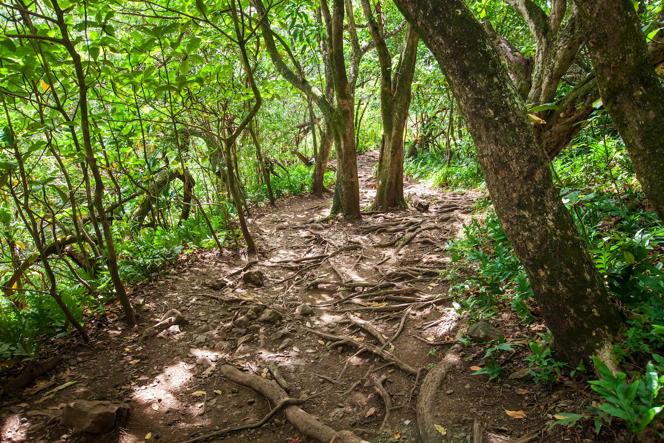
Once you enter the Kīpahulu District, you will want to park at the Visitor Center. From here, you will hike a short distance on the Kūloa Point Loop Trail and will then turn left onto the Pīpīwai Trail. This trail crosses over a road (HI-360) and continues up the mountainside. I found the hiking trail moderately difficult but entirely enjoyable.
The Pīpīwai Trail is an out and back hike, with the trail ending at Waimoku Falls. After enjoying the falls vista, you will head back down the way you came. The unpaved terrain is varied, with rocks, exposed roots, and a few steep, slippery sections, especially after rain. As such, I recommend wearing good hiking shoes with grip and bringing hiking poles, if you find them useful. I would also consider bringing a poncho as the weather can change at a moment’s notice.
Here are a few more tips recommended by the National Park Service:
- Dress for hot, humid, rainy weather.
- Fill up your gas tank and bring food. Neither are available in the park.
- Bring water, sunscreen, mosquito repellant, and wear sturdy shoes.
- Pay the entrance fee with a credit card.
- Kīpahulu is remote. Emergency medical assistance is at least one hour away.
- Leave natural resources and cultural artifacts, rocks, and structures alone.
- Flash floods and sudden rock falls can occur at any time! Entry and wading in the streams is not recommended. Always stay out of closed areas.
Best Time to Hike the Pīpīwai Trail
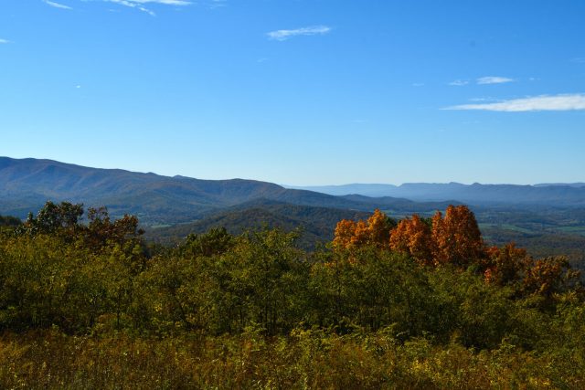
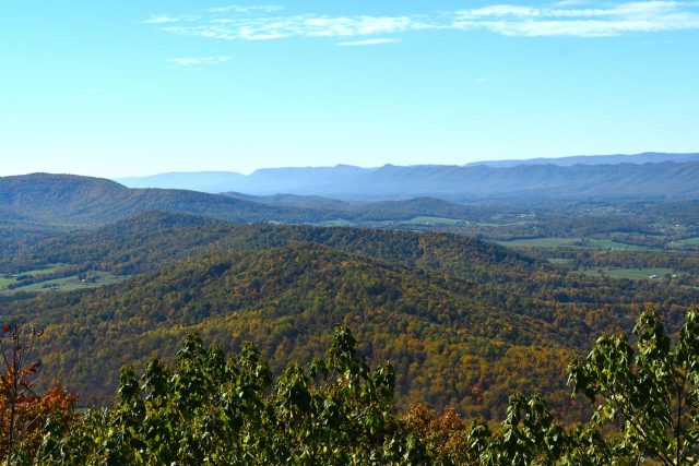
The Pīpīwai Trail is open 24 hours/day, every day of the year, pending closures due to weather or poor trail conditions. Be sure to check the main park website for current conditions. The best time of year to visit the Kīpahulu District in Haleakalā National Park will depend upon your comfort level. As it is on the windward (eastern) side of Maui, the weather is more mild and moist. According to the National Park Service, the Kīpahulu district “receives an average of 187 inches (475cm) of rain each year. The proximity of the ocean and the trade winds moderate the temperature and keep it at a daytime average of 70°-80°F (21-27°C) year round. Night time lows average 65-75°F (18-24°C).” While it rains year-round, plan on more chances of rain during the winter months.
When we went in June, the weather was perfect for us. That said, the water levels of the waterfalls were not as strong as I had been hoping for. For me, I don’t mind getting a little wet if it means I can photograph a full waterfall. If I were to go again, I may consider going in April or earlier in the year.
As it can get hot mid-day, I recommend leaving early for your hike. This will allow more gentle lighting conditions as well as fewer crowds.
Top Photography Locations and Points of Interest along the Pīpīwai Trail
Here are some of the top photography locations found along the Pīpīwai Trail:
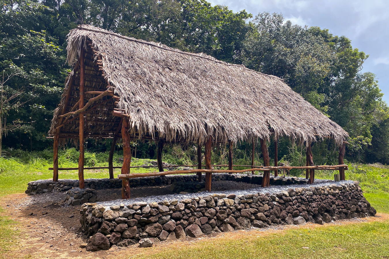
Hale Hālāwai
The Hale Hālāwai is located right where the Pīpīwai Trail branches off from the Kūloa Point Loop trail. It was rebuilt in 2019 and is intended as a place where people can meet for various cultural demonstrations and interpretive programs. (NPS)
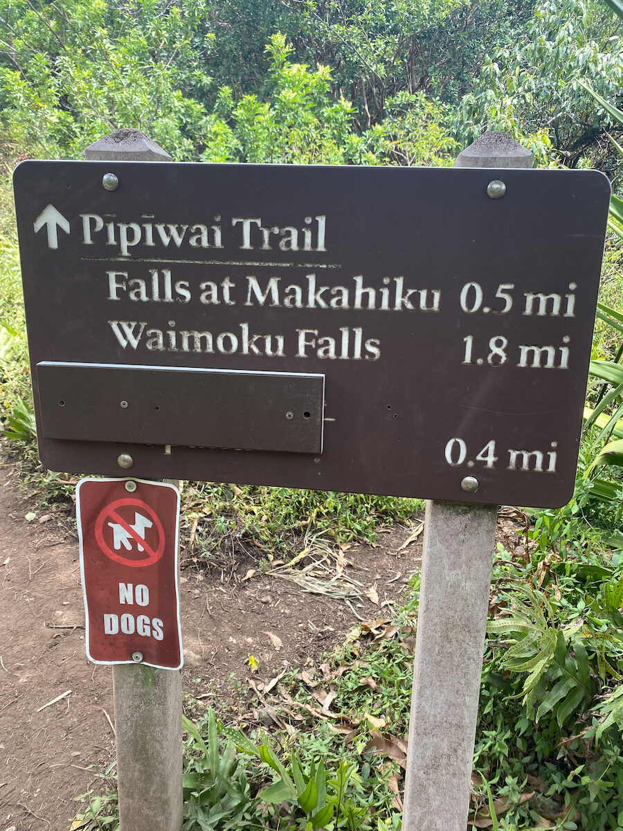
Makahiku Falls
If you are looking for a shorter hike, Makahiku Falls is a great location to give you a taste of the Pīpīwai Trail. There is a small overlook off to the right about .5 mi (.8 km) into your hike. From here you can keep hiking or turn around to head back to the parking lot. This 200 ft (61 m) waterfall is surrounded by lush greens and descends into a beautiful valley below. It is kind of far from the overlook, so I recommend bringing a telephoto lens if possible in addition to your wide-angle lens. That said, the water doesn’t flow strongly year round. When we went in the dead of summer, it was mostly dried up. (NPS)
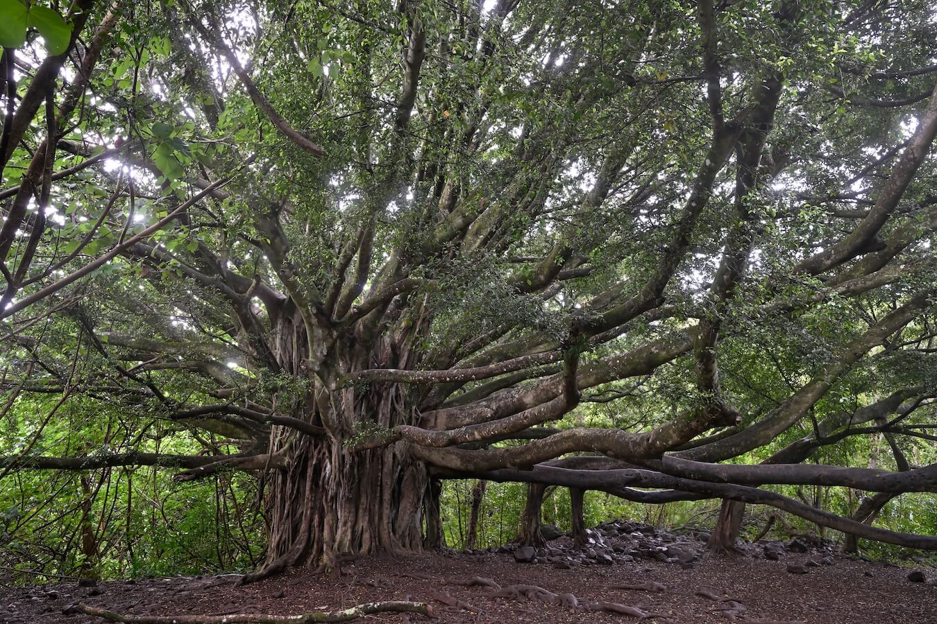
The Historical Banyan Tree
If you hike just another .5 mi (.8 km) from Makahiku Falls, on the Pīpīwai Trail, you will reach the Historical Banyan Tree. This beautiful tree is massive and a great photography subject. This banyan tree is “over 100 years old, and spread over a 60-foot diameter.” The horizontal branches of the banyan tree will eventually grow into supporting trunks. The Banyan Tree is one of the most iconic trees in the world and is a great place to stop to catch your breath while enjoying its beauty. (pipiwaitrail.org)
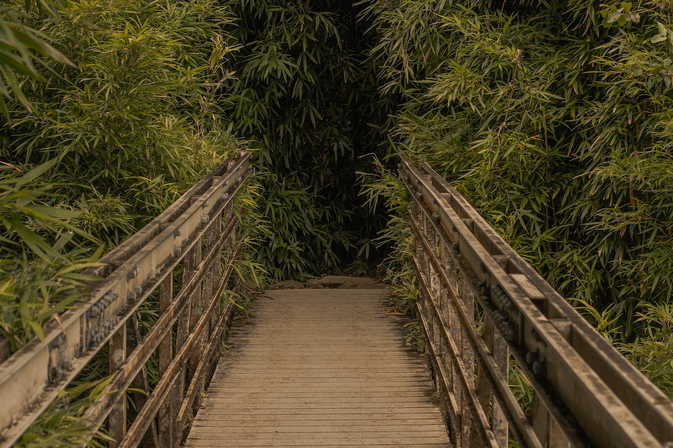
Bridges
There are several bridges of varying lengths and sizes along the Pīpīwai Trail. They provide unique photography opportunities. Most of the bridges are part of the boardwalk in the Bamboo forest. While there are many vistas from the bridges, I found that the bridges themselves also provided beautiful photography opportunities.

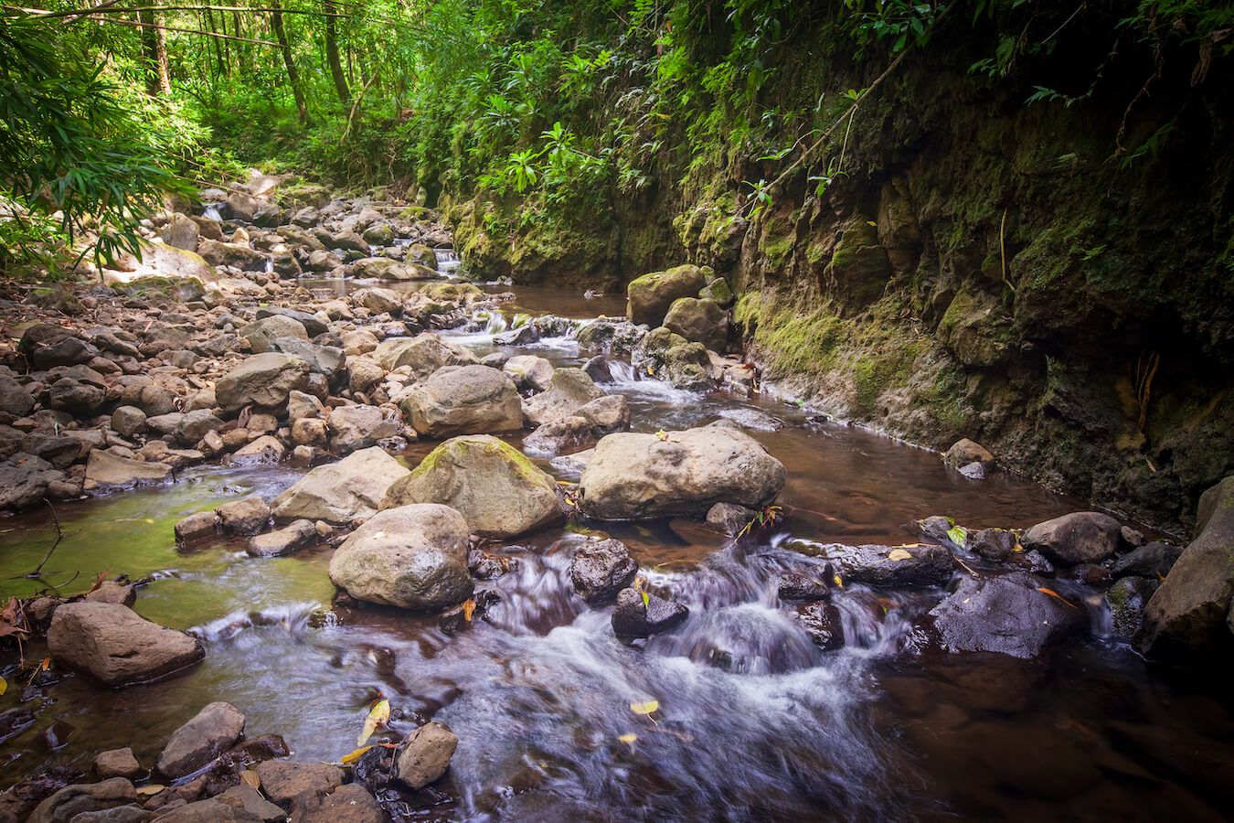
Cascades and Streams
One highlight of the Pīpīwai Trail is the small waterfall cascades found along the hike. I found myself in awe of just how beautiful they were. You will find several photography opportunities from the various water features in this section of the park.
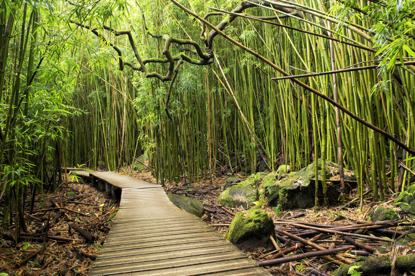
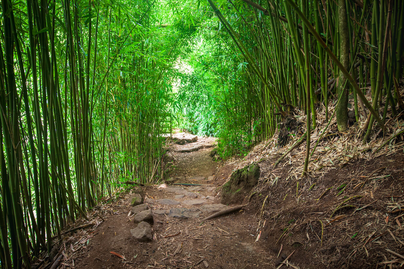
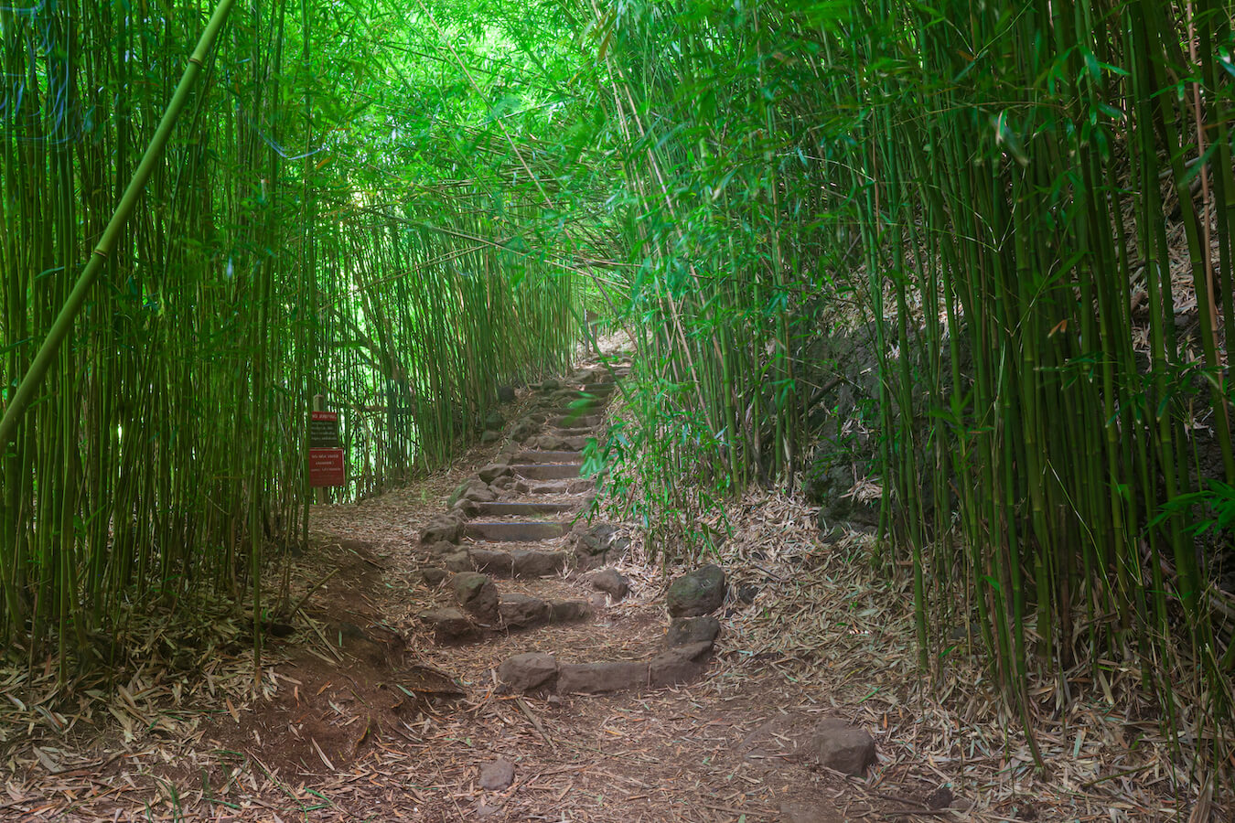
Bamboo Forests
According to the National Park Service, “Polynesian voyagers brought many plants with them on their journeys across the Pacific Ocean. One such plant was the versatile ʻohe (bamboo). When immigration to the Hawaiian Islands started to increase, new species of bamboo made their way to Hawaii. Today, many groves of different bamboo varieties can be found throughout the islands.”
The Pīpīwai Trail is home to some of these groves. I loved walking through the bamboo forests. As there was a slight breeze, the bamboo stalks made a beautiful kind of music in the background. I paused and just listened as the stalks clacked together. The bamboo forested sections were a highlight for me.
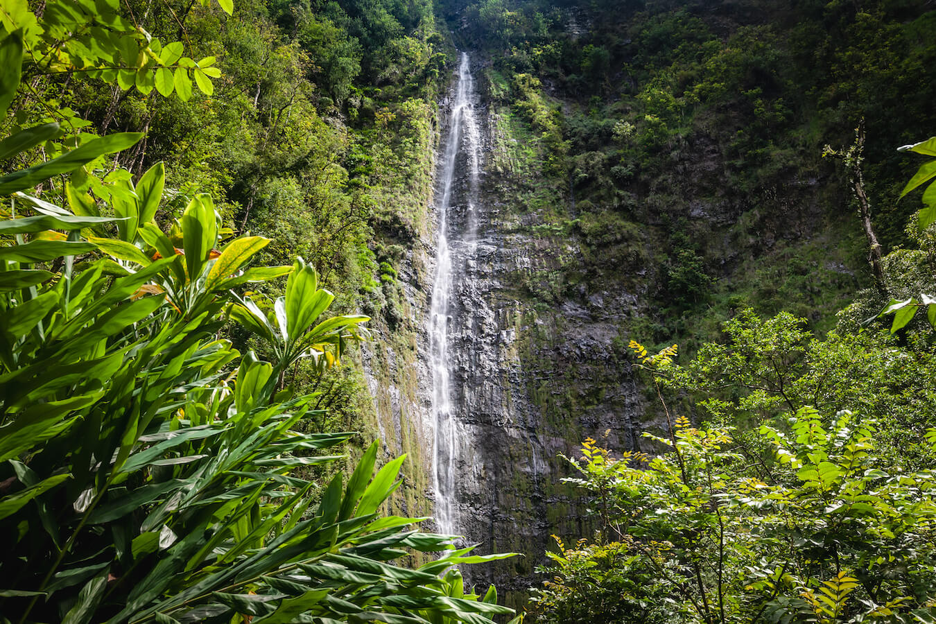
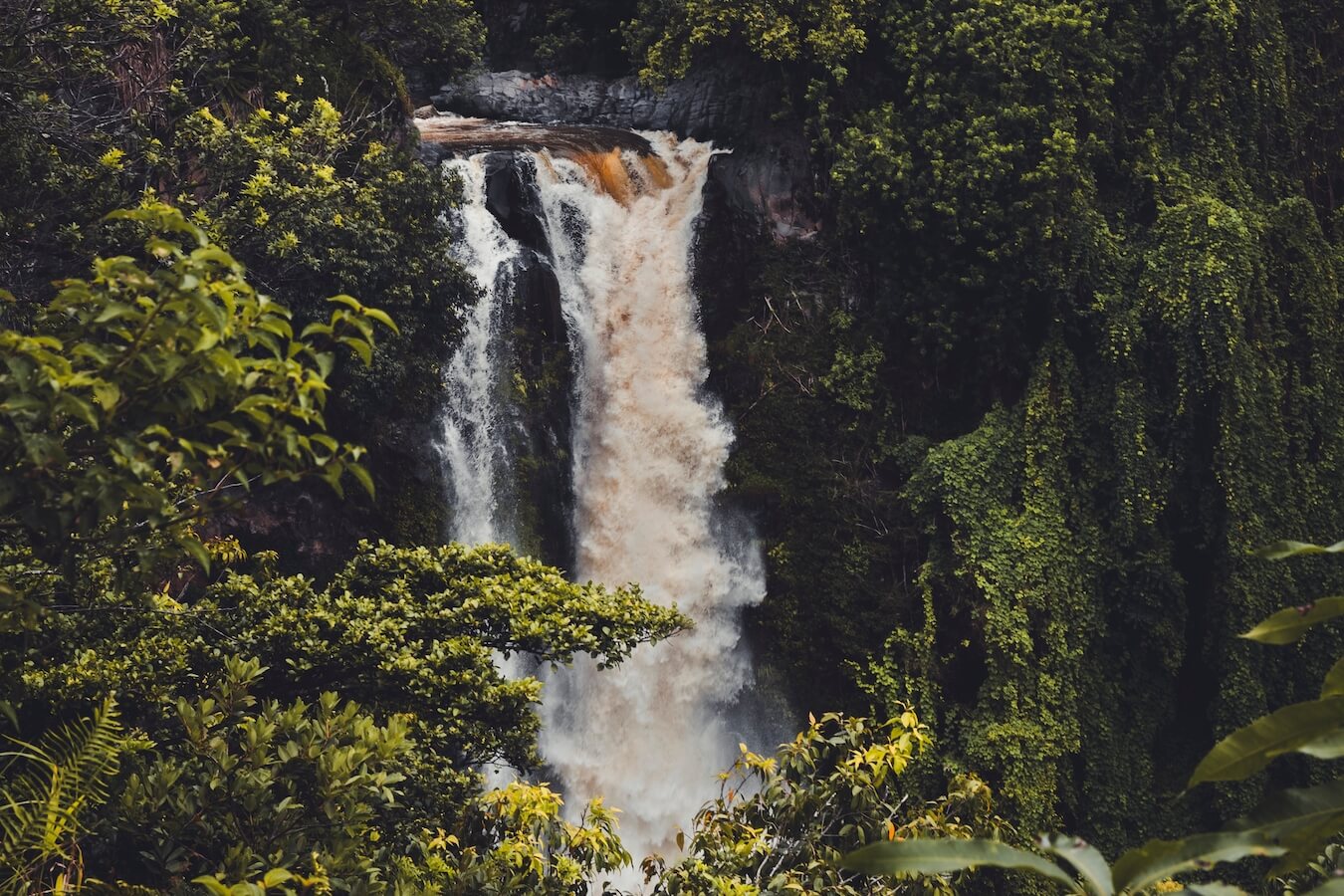
Waimoku Falls
Wamioku Falls is the main attraction at the end of the Pīpīwai Trail at roughly 2 mi (3.2 km) from the trailhead. This 400 ft (121.92 m) waterfall is visible via a boardwalk path and lookout point. As it is a small viewing area, we took turns walking up to photograph it and take our selfie. There is a sign at the end of the trail warning visitors to not go beyond that point as there have been fatalities. The area beyond the sign is purposefully overgrown and blocked. We chose to be respectful and stayed on the path during our visit.
Life Lessons from the Pīpīwai Trail
At one point along our hike, I had an epiphany that I will never forget. We had just descended quite a bit lower than our starting elevation and it occurred to me that not only did we have to ascend a lot more elevation to get to Waimoku Falls, we would also need to work hard just to regain what we lost. It felt like a slap in the face. Hoping to motivate myself, and my son who was hiking with me, I shared, “Just like we’ve lost elevation, sometimes life kicks us down and we regress. It’s just part of life. But we can’t give up. We just need to keep our eye on the end goal and eventually we will make it.” This was my two steps forward, one step back analogy, only it felt like we had gone back ten steps.
My son stopped hiking, turned to me and said, “Mom, just because we are at a lower elevation doesn’t mean we aren’t closer to our goal. We are closer than ever to our final destination.”
That hit me like a ton of bricks. At that point in my life, I felt like I had hit rock bottom. I was just a shell of the person I once was and felt like I had made backwards progress instead of forward progress. At that moment, however, I realized that it simply wasn’t true. Yes, I had been through a lot, but I had also gained a lot. Wisdom, patience, love, empathy…all unseen traits that were shaping and molding me into who I was meant to be. I just needed to see things from a different perspective.
Years of counseling culminated in a beautiful mindset shift while hiking along the Pīpīwai Trail. I felt an overwhelming compassion for myself and grace. While I had lost elevation, I hadn’t lost mileage. In fact, the only way to get to the end of the trail, with the beautiful vista of Waimoku Falls, was to push through the many ups and downs along the way. It was always part of the plan.
As we continued on our journey, I shifted my focus to the many vistas surrounding me and found joy in the journey. Being out in nature and enjoying God’s creations allowed me to slow down, reflect, and find myself. I will never forget this hike.
Find Your Favorite Location
No matter where you go in Haleakalā National Park, be sure to take your time and find your favorite location along the way. If you are lucky, you may even spot some wildlife (like the freshwater Hawaiian Goby)! Don’t forget to add detailed macro shots, change your perspective, and most importantly have fun.
Before making your trip, consider checking the official Haleakalā National Park website or contacting the park’s visitor center for the most up-to-date information on trail conditions, accessibility, and any recent changes. As with any visit to a national park, it’s important to follow park regulations, practice “Leave No Trace” principles, and prioritize safety while exploring this beautiful area. I hope you enjoy your time hiking the Pīpīwai Trail!
Happy Travels!
Juventa, Co-Owner, National Park Photographer
Want to learn more about Haleakalā National Park? Check out these maps, guides & books:
- Haleakala National Park Map (National Geographic Trails Illustrated Map)
- Haleakala National Park Map & Illustrated Trails: Guide to Hiking , Camping and Exploring Haleakala National Park
- Haleakala: The Story Behind the Scenery (Discover America: National Parks)
- Haleakala: Images of the House of the Sun
- The Adventure Handbook To Haleakala National Park: Discover and plan for the best day trip activities to explore at Haleakala National Park
- GEOLOGICAL GUIDE TO HALEAKALA NATIONAL PARK
Please note, by making purchases through our affiliate links, you are supporting our mission to celebrate and showcase our National Parks and the photographers who frequent them. As an Amazon Associate, National Park Photographer earns from qualifying purchases at not cost to you. We appreciate your support.