Length: .1 mi (.16 km)
Elevation Gain: 105 ft (32 m)
Route Type: Out and Back
Difficulty: Moderate
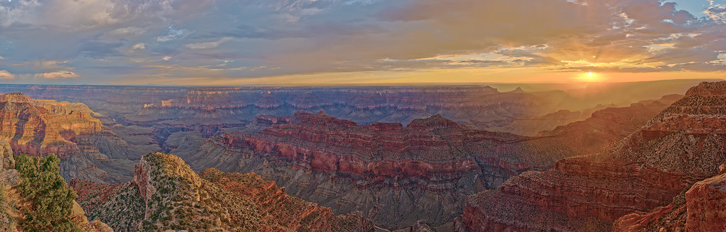
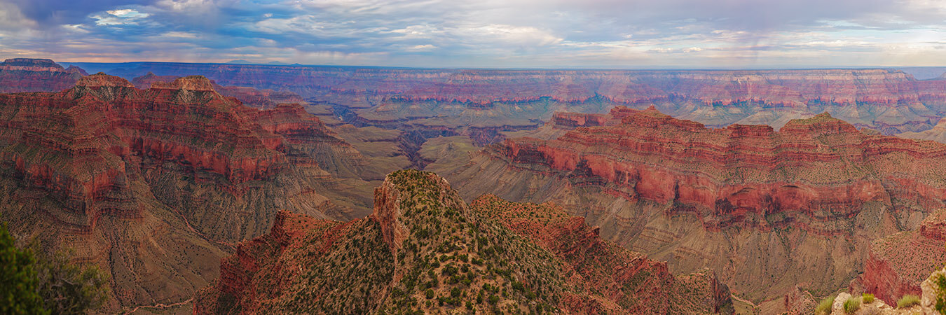
The Point Sublime Peninsula offers 270 degree views of the North Rim of Grand Canyon National Park. This location is far less visited and hard to reach by a normal car. (Road Less Traveled) If you do happen to make it out here, enjoy the breathtaking views!
To access the vista, start at the south end of the Point Sublime parking area. From here you will descend a short slope on a faint gravel trail heading south toward the rim of the Grand Canyon. You will have to descend down a couple of steep descents before the trail levels out some. Some caution is advised as you make these descents as there are many loose rocks and tree roots to trip over.
Accessing Point Sublime on the North Rim of the Grand Canyon
Starting Location: Parking lot at the end of Point Sublime, North Rim, AZ
GPS (DD): 36.198419, -112.250672
Point Sublime is west of the developed North Rim area in the Kaibab National Forest. A high clearance 4×4 Jeep, SUV or pickup truck, is required. Reaching this free dispersed camping area is certainly not for the faint of heart! We have been to this location 3 times starting in 2018. The last time was October 2024 and the road has gotten much worse. In several areas we were crawling over rocks in washed out areas of the road in 4-wheel Low because it was so rough.
This narrow, rugged road should only be attempted by very experienced back country drivers. It is recommended to bring a saw, an axe, and a winch as the trail can often be blocked by fallen trees. The access to this location is through Kaibab National Forest and not in the National Park.
The road is closed from late October to early May due to heavy snows on the North Rim. You only enter the National Park about .25 mi (.4 km) north of the parking lot. An accurate back country map and GPS with back country maps is highly recommended. Make sure you have your Bunny Trails turned on in your GPS to help you backtrack back out of the area.
We started at Jacobs Lake at the junction of US Highway 89A and State Highway 67. Drive southbound on Highway 67. You will come to the entry gate for Grand Canyon National Park 31 miles (49.9 km) south on 67. You will need to pay the park entry fee.
From the entry gate continue 9.8 miles (15.8 km) to the Point Sublime Trail turn off on the west side of Highway 67 (approximately 52.4 miles (84.3 km) south of Jacobs Lake) at GPS coordinates 36.224596, -112.059520. (Note: This turnoff is about 2.7 miles (4.3 km) north of the North Rim Visitor Center.) The trail isn’t well marked so watch for the Widforss Trailhead sign. From this turnoff it is about 17.4 miles (28 km) to Point Sublime.
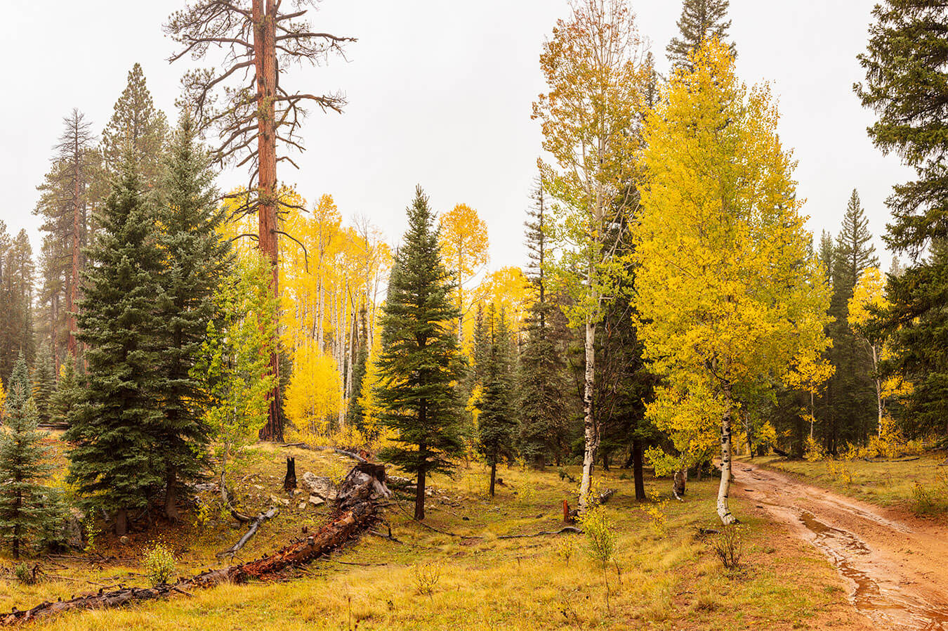
From Highway 67, drive west through a wide green meadow. The trail passes the Widforss Trailhead off to the left after 0.6 miles (1 km). Follow the signs to the right pointing the way towards Point Sublime Trail. It was at this point I put the Jeep in 4-wheel drive because the climb is steep. Continue on Point Sublime Trail for 10.8 miles (17.4 km) to GPS coordinates 36.25573, -112.199473.
You will encounter several areas that will require 4-wheel Low (4L) to crawl over washouts in the road. At the 10.8 mile (17.4 km) point you will come to a junction. Take the left fork in the road heading southwest. Continue another 6 miles (9.7 km) on this road. We left the Jeep in 4-wheel Low driving this stretch of road too because there are many areas where the road is badly washed out. As you approach the Point Sublime parking area you will notice some camp sites along the road. Continue until the road comes to a dead end and at this point you have arrived.
Travel Tips at Point Sublime and the North Rim of the Grand Canyon
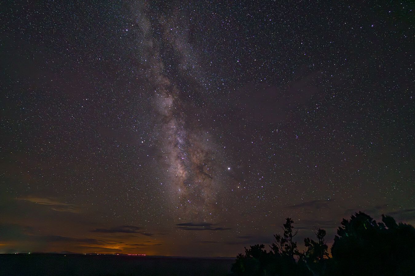
There are numerous viewpoints overlooking the North Rim of the Grand Canyon west of Highway 67. These are all accessed via the Kaibab National Forest access roads. These roads are generally closed in the winter months from late October to April. Only experienced back country travelers should attempt traveling these roads. Point Sublime has some back country camping area with numerous tent sites. There is a 14 day camping limit. There are no facilities. At the edge of the rim there is limited cell service from the south rim. Some sites have picnic tables. The overlook at the edge of the rim is fairly small and there are no benches to sit on.
Photography Tips at Point Sublime
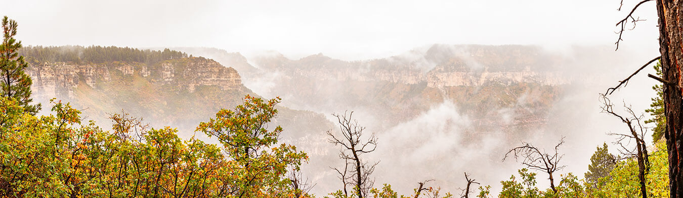
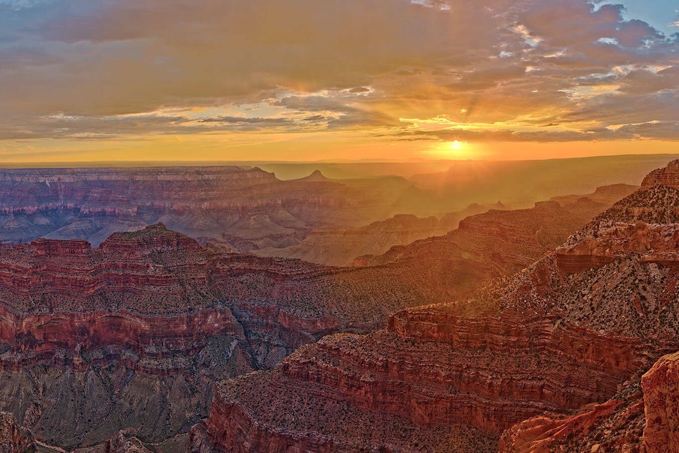
Ideally, this location should be photographed during the morning or evening Golden Hours. Sunsets would be especially nice during late May, June and early July because the sun sets further north and shines nicely along the length of the canyon. This is why I mentioned camping because I would not recommend traveling into or out of this location after dark. The Monsoon season in July could be good for nice storms and lightning shoots. However, the roads can be difficult if they get wet and muddy. Most people will likely want to use a wide angle lens 24mm or wider.
For my photo “Monsoon Sunset at Point Sublime” featured on this page, remember the old TV commercial where a little girl and her Daddy are watching a sunset. As the sun dropped below the horizon she says “Do it again Daddy”. That is exactly the feeling I had on this evening as we watched this sunset. I wanted to say to my Heavenly Father to “Do it again Daddy”. Each and every day He creates unique sunrises & sunsets that will never be repeated. This was one of His masterpieces.
For my header image featured on this page, I used a Canon R5 camera body, Canon 70-200mm lens @70mm, f/13, 1/50th, 1/400th and 1/6th sec. exposure, ISO 100. It is made up of 525 Bracketed images processed to yield 175 individual HDR images, 5 rows x 35 columns 45% overlap in portrait orientation to produce final image 1.06 Giga-pixels, measuring 61″ x 192″. For information about purchasing my “Monsoon Sunset at Point Sublime” image, click here.
Closing Remarks
Between Point Sublime and Crazy Jug Point, Point Sublime still remains my favorite for scenic quality. Point Sublime offers one of the most panoramic views of the west-central portion of the canyon from the North Rim. Rivaled in splendor only by Cape Royal many miles to the east. A relatively few people get to experience Point Sublime, largely due to the rough and narrow 17 mile (27.3 km) dirt road that needs to be traversed to reach this epic viewpoint. Unfortunately, the road to Point Sublime has degraded to the point that it has became quite challenging to get there.
Find Your Favorite Location
No matter where you go in Grand Canyon National Park, be sure to take your time and find your favorite location along the way. If you are lucky, you may even spot some wildlife! Don’t forget to add detailed macro shots, change your perspective, and most importantly have fun.
Before making your trip, consider checking the official Grand Canyon National Park website or contacting the park’s visitor center for the most up-to-date information on trail conditions, accessibility, and any recent changes. As with any visit to a national park, it’s important to follow park regulations, practice “Leave No Trace” principles, and prioritize safety while exploring this beautiful area. If you can make it, enjoy your time exploring the natural wonders of Point Sublime!
Happy Travels!
John Freeman, Featured National Park Photographer
Want to learn more about Grand Canyon National Park? Check out these maps, guides & books:
- Grand Canyon, North and South Rims [Grand Canyon National Park] (National Geographic Trails Illustrated Map)
- National Geographic Park Profiles: Grand Canyon Country: Over 100 Full-Color Photographs, plus Detailed Maps, and Firsthand Information
- Lonely Planet Grand Canyon National Park 6 (National Parks Guide)
- A Complete Guide to the Grand Circle National Parks: Covering Zion, Bryce Canyon, Capitol Reef, Arches, Canyonlands, Mesa Verde, and Grand Canyon National Parks (English and Japanese Edition)
- Grand Canyon National Park (Postcard History Series)
Please note, by making purchases through our affiliate links, you are supporting our mission to celebrate and showcase our National Parks and the photographers who frequent them. As an Amazon Associate, National Park Photographer earns from qualifying purchases at not cost to you. We appreciate your support.