Length: Minimal – 1.6 mi (2.6 km)
Elevation Gain: Minimal – 80 ft (26 m)
Route Type: Out and Back
Difficulty: Easy
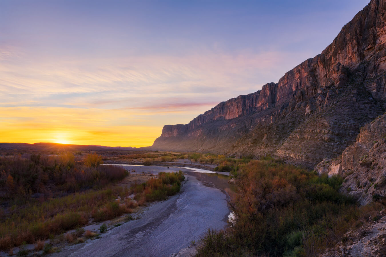
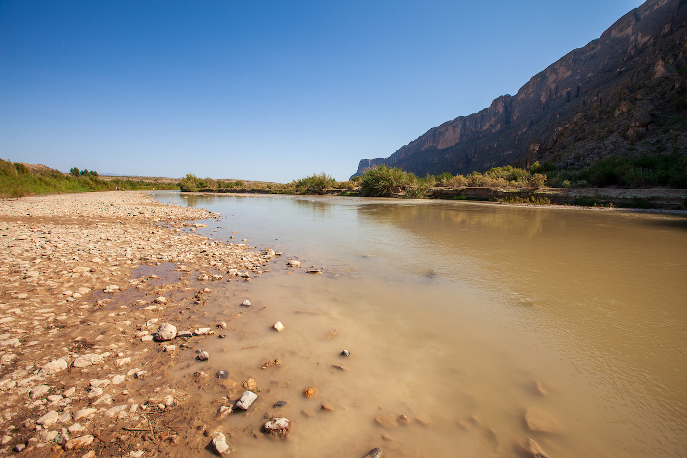
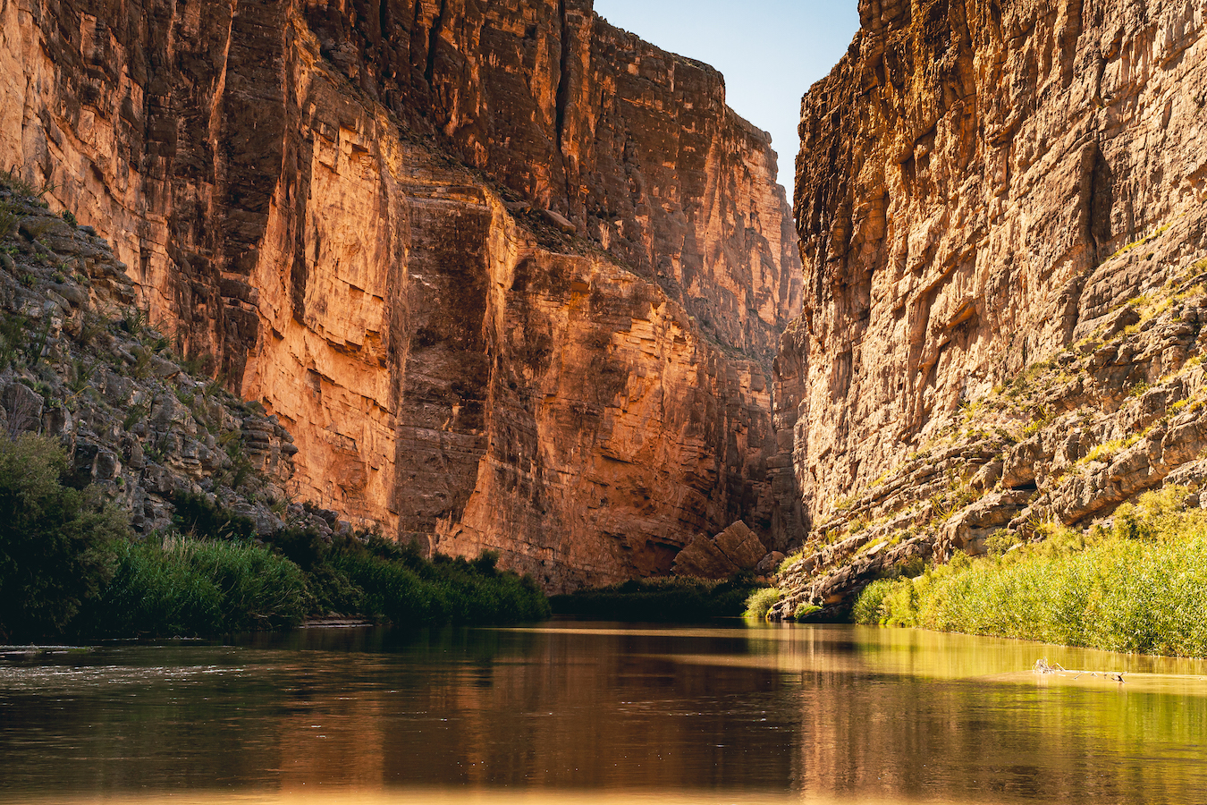
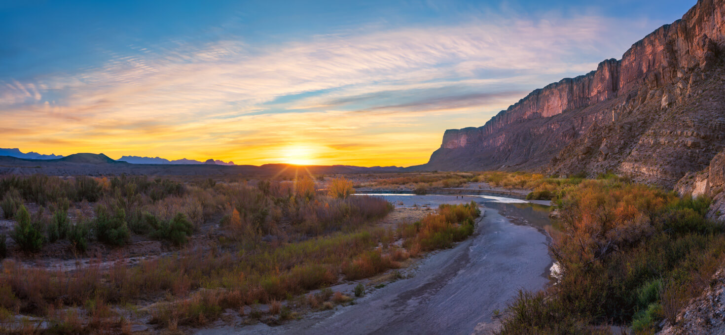
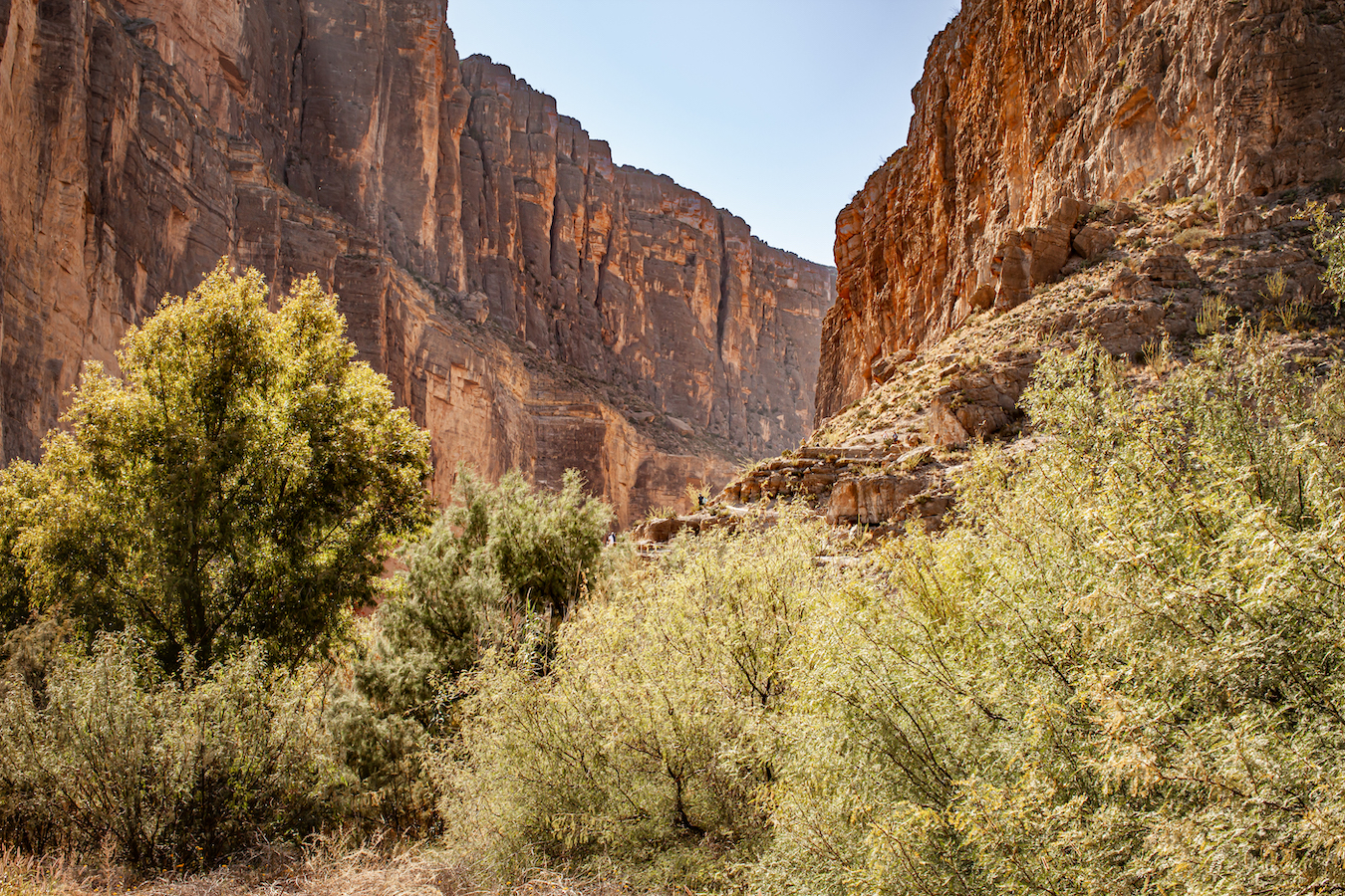
Santa Elena Canyon is one of the most popular features of Big Bend National Park. The canyon features 1,500 ft (457 m) walls cut by the Rio Grande River, which forms the border between Texas and Mexico. Terlingua Creek meets the Rio Grande River just outside of the canyon and provides additional photography options at this location.
Accessing Santa Elena Canyon in Big Bend National Park
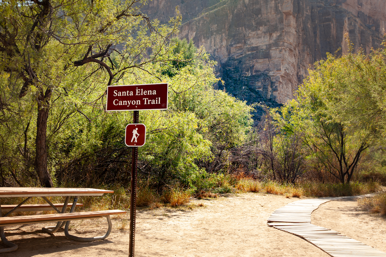
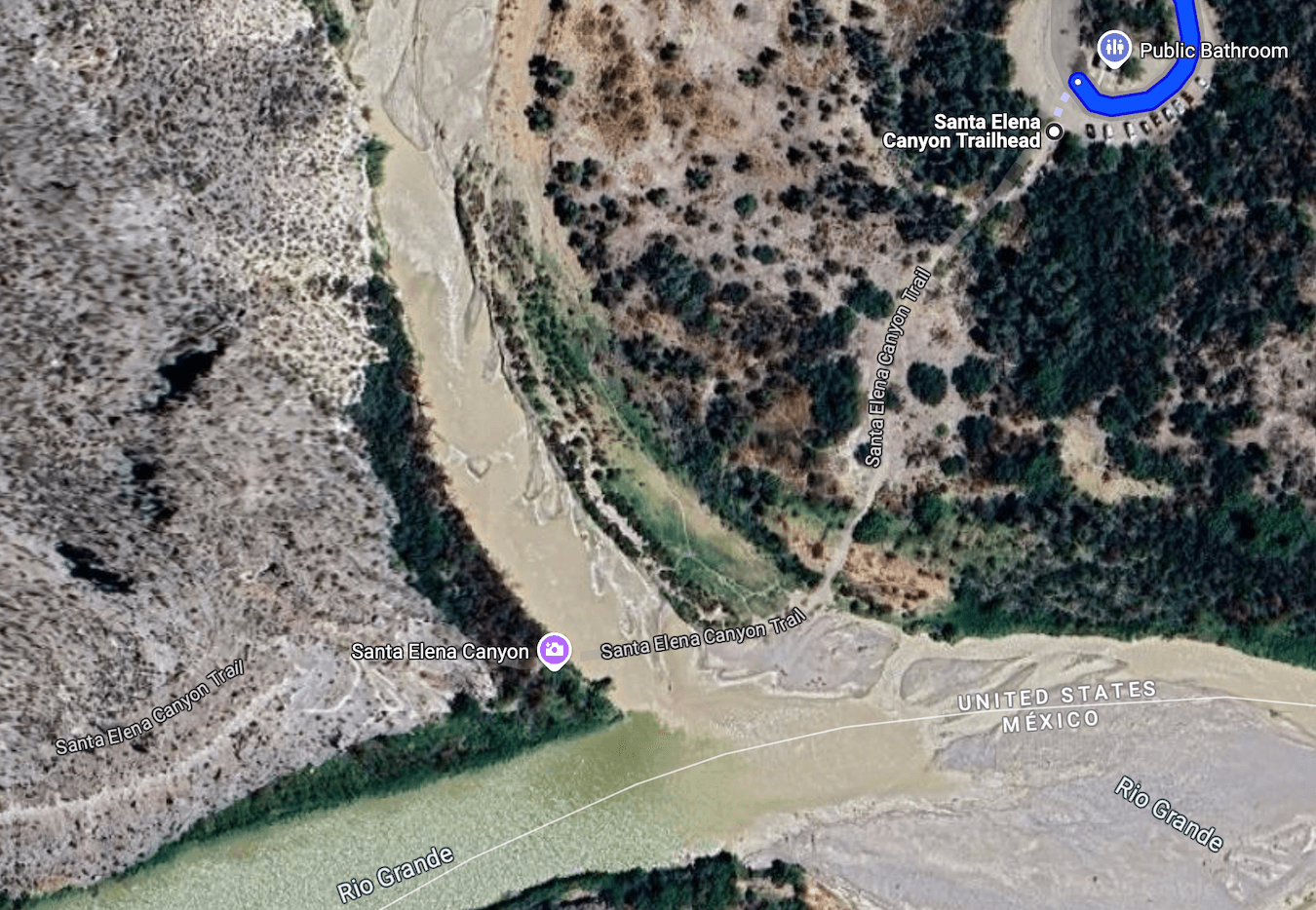
Starting Location: Santa Elena Canyon Trailhead, Terlingua, TX
GPS (DD): 29.167346, -103.610339
The Santa Elena Canyon Trailhead is located at the end of the Ross Maxwell Scenic Drive. The main vista of the Santa Elena Canyon can be accessed by a short hike (about 500 ft or 152 m) from the parking area, which has a public restroom. The parking area is located about 15 minutes from the Castolon Visitor Center, and about an hour from the Panther Junction and Chisos Basin Visitor Centers.
Best Time of Day to Photograph Santa Elena Canyon
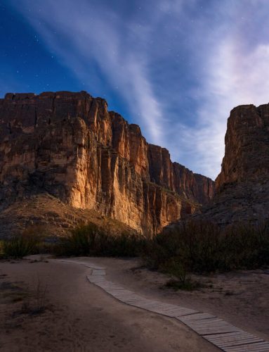
Sunrise or sunset are the best times of day to photograph this location to get soft light in the area. There are so many different possibilities of compositions that can take advantage of the light during sunrise and sunset. Even under a full moon, it can cast soft light on the canyon walls making for an excellent photo opportunity.
Best Seasons to Photograph Santa Elena Canyon
Weather in Big Bend National Park varies dramatically between winter and summer months. Make sure you’re checking the weather and taking plenty of water if you’ll be out in the heat. Photographing at sunrise or sunset will help avoid the hottest parts of the day. Spring is warm and pleasant and is the busiest season for Big Bend. Summer heat starts in May through August, and fall starts in October and transitions quickly into winter.
July through September is the rainy season, which has heavy thunderstorms that can lead to flash flooding. While the rains may cool off desert heat, it can cause the Terlingua Creek and Rio Grande Rivers to be impossible to cross.
The water levels of Terlingua Creek and the Rio Grande River will affect how many areas are accessible to explore. Higher water levels will limit access, although there are still photographic opportunities even with higher water levels. Lower water levels will allow easier access to the canyon and across Terlingua Creek, which offers some great compositions.
Weather and water levels can be checked on the National Park Service website. Keep in mind, the forecasts are for the Chisos Basin area, which is about 3,000 ft (914 m) higher than Santa Elena Canyon.
Photography Tips for Santa Elena Canyon
There are lots of compositions to photograph in this location, including the canyon and the surrounding area. From the main parking area, the Santa Elena Canyon Trail leads you directly down to the Rio Grande River where you can look into the canyon opening.
In addition to the stunning views, another exciting part of visiting the Santa Elena Canyon is that you can see and photograph parts of Mexico right across the Rio Grande River. That said, crossing the Rio Grande River into Mexico is illegal and can result in legal trouble. If you want to visit Mexico while on your trip to Big Bend National Park, you can enter via the Boquillas Crossing Port of Entry.
Another great photography location is the Santa Elena Canyon Overlook. This overlook is located on the Ross Maxewell Scenic Drive on the way down to the Santa Elena Canyon parking area. There is a pull off that has an elevated view of the canyon opening that can provide nice photographic compositions. The Santa Elena Canyon Overlook is located at GPS (DD): 29.168486, -103.603944.
When water levels are low, you can also access the rest of the Santa Elena Canyon Trail. This begins at Terlingua creek. Crossing Terlingua Creek leads to some elevated vantage points where you can photograph wide expanses of the area and the mountains across the Rio Grande River.
Hiking the Santa Elena Canyon Trail
If you are up for getting your feet a little bit wet, you can hike the Santa Elena Trail. This hiking trail is 1.6 mi (2.6 km) out and back with en elevation gain of 80 ft (26 m). If you decide to do this hike, be sure to bring extra socks and water with you. (Click here for a complete list of our favorite photography and hiking gear.)
According to the National Park Service, the Santa Elena Trail is “one of the prettiest short trails in the park. To access the trail, hikers must first cross the bed of Terlingua Creek, and climb a short but steep bank. As the trail enters the canyon mouth, it climbs a series of concrete steps to a high viewpoint. From the viewpoint, the trail slopes gradually down to the river’s edge and continues winding among large boulders until it ends abruptly where the canyon wall meets the Rio Grande. This is one of the narrowest places in the seven-mile long Santa Elena Canyon.” (NPS)
After you finish hiking to the end of the Santa Elena Canyon Trail, you will want to head back out the way you came. As the main vista is partway up the trail, you can choose to turn back at any point.
Closing Remarks
Santa Elena Canyon is an impressive canyon with beautiful surrounding areas. The flow of Terlingua Creek and the Rio Grande River will offer varying levels of accessibility and compositions.
Find Your Favorite Location
No matter where you go in Big Bend National Park, be sure to take your time and find your favorite location along the way. If you are lucky, you may even spot some wildlife! Don’t forget to add detailed macro shots, change your perspective, and most importantly have fun.
Before making your trip, consider checking the official Big Bend National Park website or contacting the park’s visitor center for the most up-to-date information on trail conditions, accessibility, and any recent changes. As with any visit to a national park, it’s important to follow park regulations, practice “Leave No Trace” principles, and prioritize safety while exploring this beautiful area. I hope you enjoy your time visiting Santa Elena Canyon!
Happy Shooting!
Tom Wagner, Featured National Park Photographer
Want to learn more about Big Bend National Park? Check out these maps, guides & books:
- Big Bend National Park Map (National Geographic Trails Illustrated Map)
- Hiking Big Bend National Park: A Guide to the Big Bend Area’s Greatest Hiking Adventures, including Big Bend Ranch State Park (Regional Hiking Series)
- Enjoying Big Bend National Park: A Friendly Guide to Adventures for Everyone (Volume 41) (W. L. Moody Jr. Natural History Series)
- Big Bend National Park: A Photographic Journey
- Death in Big Bend
Please note, by making purchases through our affiliate links, you are supporting our mission to celebrate and showcase our National Parks and the photographers who frequent them. As an Amazon Associate, National Park Photographer earns from qualifying purchases at not cost to you. We appreciate your support.