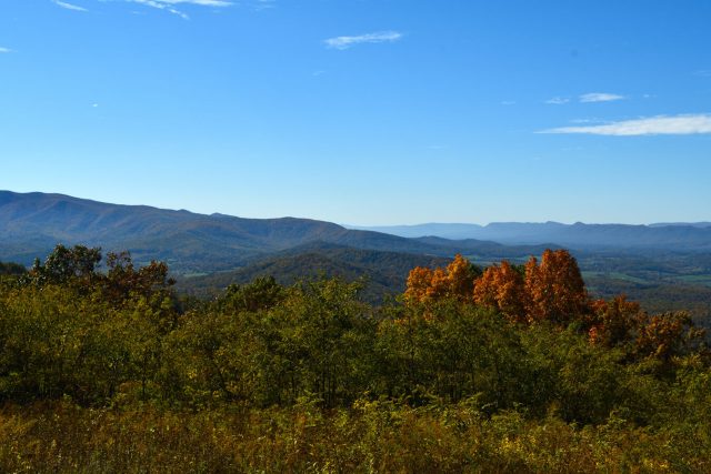
Shenandoah National Park, located in the Blue Ridge Mountains of Virginia, is a scenic paradise that offers a tranquil escape into nature. The park is renowned for its stunning vistas, cascading waterfalls, and vibrant fall foliage. Visitors can hike along the Appalachian Trail, meander through peaceful forests, and enjoy breathtaking views from Skyline Drive, a scenic roadway that winds through the park. Shenandoah National Park is also home to diverse wildlife, including white-tailed deer, black bears, and a variety of bird species. With its natural beauty and recreational opportunities, the park invites visitors to reconnect with nature and experience the wonders of the Appalachian Mountains. Be sure to visit the park website for current closures and conditions.
Map of Shenandoah National Park
Top Photography Locations and Sights at Shenandoah National Park:
As photographers, we know that many of you will only have one chance in a lifetime to visit the National Parks. To make your life easier, we have compiled a list of our top photography locations and sights at Shenandoah National Park! While this is not comprehensive, and there are many more amazing sights to see, it should give you a good feel for the park.
Skyline Drive
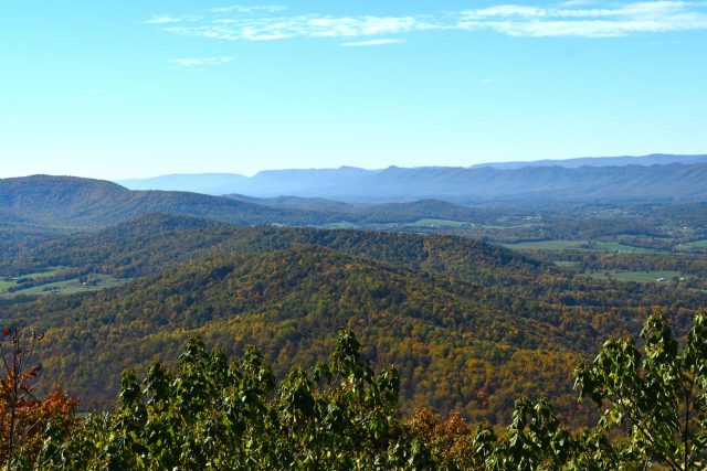
Skyline Drive (mileposts 0-105.4) is the scenic backbone of Shenandoah National Park, a 105-mile road stretching from Front Royal to Rockfish Gap, offering stunning views of the Blue Ridge Mountains, rolling valleys, and vibrant forests. Winding through the park’s North, Central, and South Districts, it provides access to numerous trailheads, overlooks, and visitor centers, making it a must-drive for nature lovers.
North District
Shenandoah National Park’s North District (mileposts 0–31.5), encompassing the northern third of the park, is a serene gateway to Virginia’s Blue Ridge Mountains. Spanning from the Front Royal entrance to Thornton Gap, it features iconic trails like Overall Run Falls, the park’s tallest waterfall, and the scenic Compton Peak. Skyline Drive winds through lush forests and open vistas, offering access to serene picnic spots and the historic Dickey Ridge Visitor Center. With diverse wildlife and seasonal wildflowers, the North District invites hikers, photographers, and nature lovers to explore its tranquil beauty.
This district includes the Dickey Ridge Area, Compton Gap Area, Keyser Run Area and Mathews Arm Area which serves as the northern gateway to the park. These areas collectively offer iconic hikes like Overall Run Falls and Compton Peak, and visitor facilities. Please note, although Keyser Run Area and Mathews Arm Area do have overlapping mileposts, they are distinct areas within the park.
Dickey Ridge Area | Mileposts 0.0 to 9.2
Compton Gap Area | Mileposts 9.2 to 19.4
Keyser Run Area | Mileposts 19.4 to 24.0
Mathews Arm Area | Mileposts 22.1 to 31.5
Central District
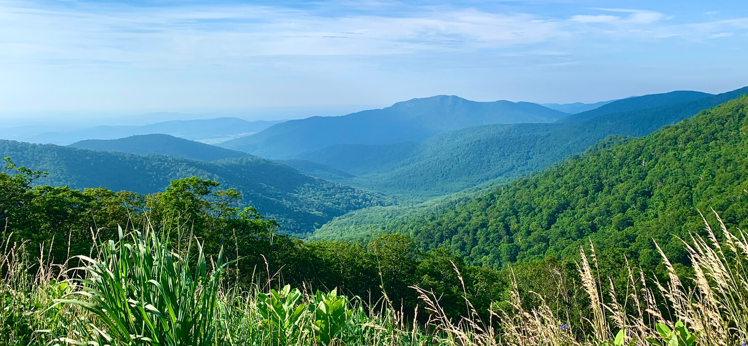
Shenandoah National Park’s Central District (mileposts 31.5–65.7), stretching from Thornton Gap to Swift Run Gap, is the heart of the park’s rugged splendor. This area boasts some of the park’s most famous trails, like Hawksbill Summit, the highest peak in Shenandoah, and viewpoints offering glimpses of Old Rag Mountain. Skyline Drive meanders through hardwood forests and panoramic overlooks like Stony Man, perfect for breathtaking sunsets. Home to the Harry F. Byrd Visitor Center, the Central District offers rich history, diverse flora and fauna, and endless opportunities for hiking, photography, camping, and wildlife spotting.
This district includes the Thornton Gap Area, Skyland Area, Whiteoak Canyon Area, Hawksbill Area, Big Meadows Area, Rapidan Camp Area, and Bearfence Area, a hub for iconic trails and visitor amenities within the park. These areas offer renowned hikes like Hawksbill Summit, Whiteoak Canyon Falls, and Bearfence Rock Scramble, alongside major facilities such as Skyland Resort and Big Meadows Lodge. Please note, the South River Area beginning at milepost 62.8 overlaps two districts (Central and South) and is included in the South District section further below.
Thornton Gap Area | Mileposts 31.5 to 39.0
Skyland Area (includes Whiteoak Canyon Area & Hawksbill Area) | Mileposts 39.0 to 49.4
Big Meadows Area (includes Rapidan Camp Area) | Mileposts 49.4 to 56.4
Bearfence Area | Mileposts 56.4 to 62.8
South District
Shenandoah National Park’s South District (mileposts 65.7–105.4), extending from Swift Run Gap to Rockfish Gap, offers a quieter, less-traveled escape into Virginia’s Blue Ridge Mountains. This region features diverse trails like the serene Blackrock Summit with its sweeping views and the challenging Riprap Trail with its streams and swimming holes. Skyline Drive winds through rolling meadows and dense forests, dotted with overlooks like Crimora Lake and Calf Mountain. Rich in wildlife and seasonal beauty, the South District is ideal for hikers, birdwatchers, and those seeking solitude in nature.
This district includes the South River Area, Loft Mountain Area, and Riprap Area, a serene region known for its tranquil beauty. These areas provide access to diverse trails to waterfalls, overlooks and summits, catering to those seeking both challenging treks and panoramic views. Please note, the South River Area begins at milepost 62.8, but is included in this section since it overlaps two districts (Central and South).
South River Area | Mileposts 62.8 to 79.5
Loft Mountain Area | Mileposts 79.5 to 90.0
Riprap Area | 90.0 to 105.4
Old Rag Mountain
Old Rag Mountain, despite its popularity and prominence within Shenandoah, is accessed from outside the park’s boundaries via Route 600 in Madison County. This area is unique because the trailhead lies on private land adjacent to the park, requiring hikers to approach from outside rather than from Skyline Drive.