Length: 2.9 miles (4.6 km)
Elevation Gain: 625 ft (191 m)
Route Type: Loop
Difficulty: Moderate
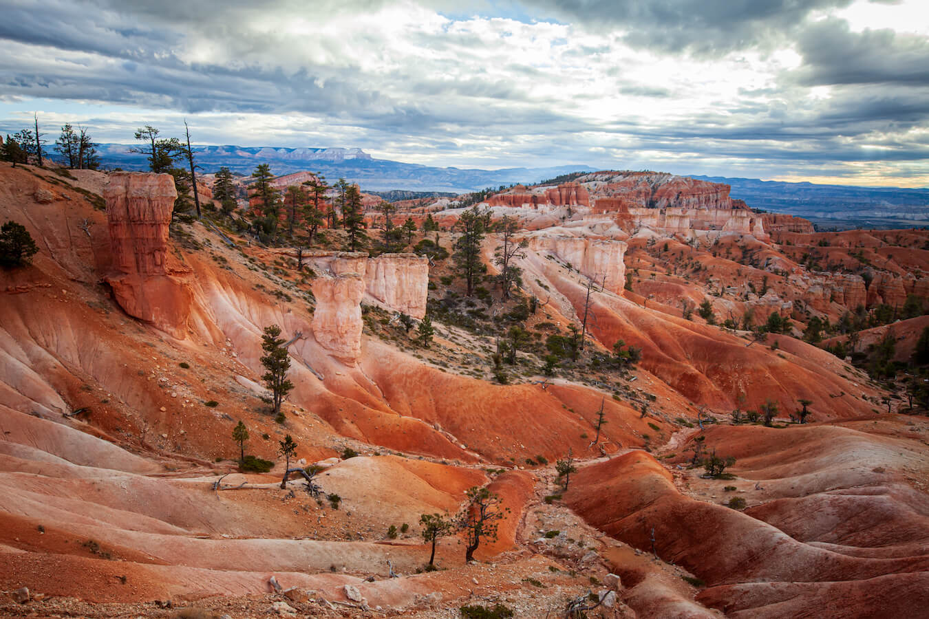
If you only have time for one hike at Bryce Canyon National Park, the Queen’s Garden/Navajo Combination Loop is by far my favorite hike. This hike includes stunning vistas, neatly marked hiking trails, amazing photography opportunities, as well as a steep ascent through towering hoodoos. Though moderately challenging, it is also family friendly. As this is Bryce Canyon’s most popular trail, you will want to get there early to ensure parking, good lighting, and a pleasant trip. Keep reading to learn more about this amazing hike and to experience the Queen’s Garden/Navajo Combination Loop for yourself!
Accessing the Queen’s Garden/Navajo Combination Loop
Starting Location: Sunrise Point or Sunset Point Parking Lot
GPS (DD): 37.628452, -112.162968 (Sunrise Point)
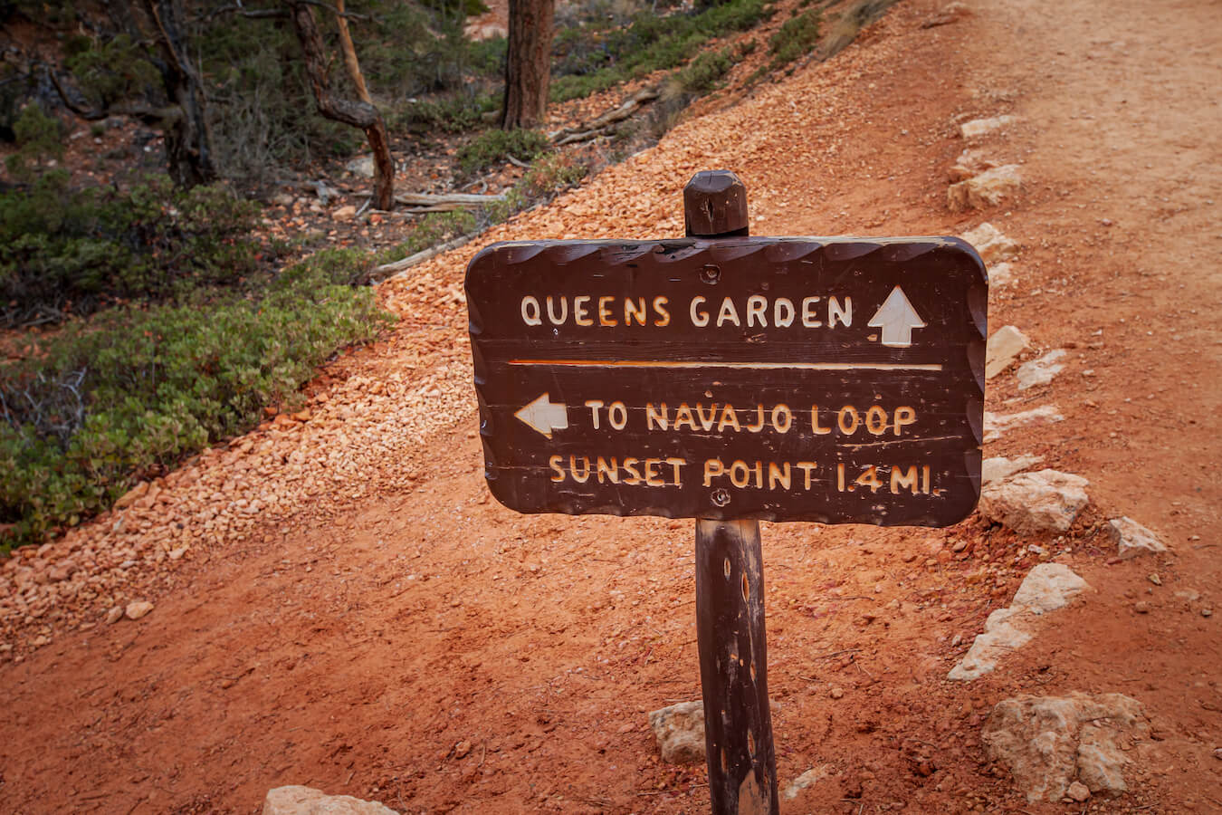
The Queen’s Garden/Navajo Combination Loop can start at either Sunrise Point or Sunset Point in Bryce Canyon National Park. Beginning your hike at Sunset Point will start you off on the Navajo Loop Trail whereas Sunrise Point starts with the Queen’s Garden Trail.
Be sure to check the park website for current road conditions as there are sometimes road closures, especially during the winter months. That said, the first 3 miles of the main park road in Bryce Canyon are the first to be plowed and so the closures will usually be temporary. As this is a popular stop in the park, you can also use the park shuttle in the summer months to access Sunrise and Sunset Point.
Recommended Hiking Pattern for the Queen’s Garden/Navajo Combination Loop
While some people begin the Queen’s Garden/Navajo Combination Loop Hike at Sunset Point via the Navajo Loop Trail, I don’t recommend it. Instead, I highly recommend starting at Sunrise Point on the Queens Garden Trail. Once you pass by the hoodoo formation coined “Queen Victoria” connect with the Navajo Loop Trail.
From here you can choose two options. You can ascend up to the Sunset Point parking lot via Wall Street (closed in winter) or if you want to pass by Thor’s Hammer on your way back up, then you can take the Two Bridges side of the Navajo Loop. Both of these options end at the Sunset Point Parking lot. From here you can take the Rim trail back to Sunrise Point or you can take a shuttle bus back to Sunrise Point in the summer months back.
I recommend this hiking pattern for two reasons:
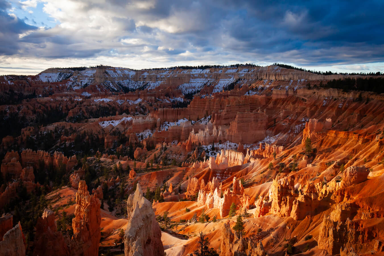
First, by beginning the hike at Sunrise Point, we were able to watch and photograph the sunrise over the Bryce Amphitheater before starting our hike. We arrived 20 minutes before sunrise, and while it was crowded, we still got a parking spot. I quickly ran to the top of sunrise point, set up my tripod, and then began taking pictures. Afterwards, we began our hike down the Queens Garden Trail. Hiking down the Queen’s Garden Trail just after sunrise allowed us to continue enjoying the early morning light and sunrise well into our hike. It was spectacular!

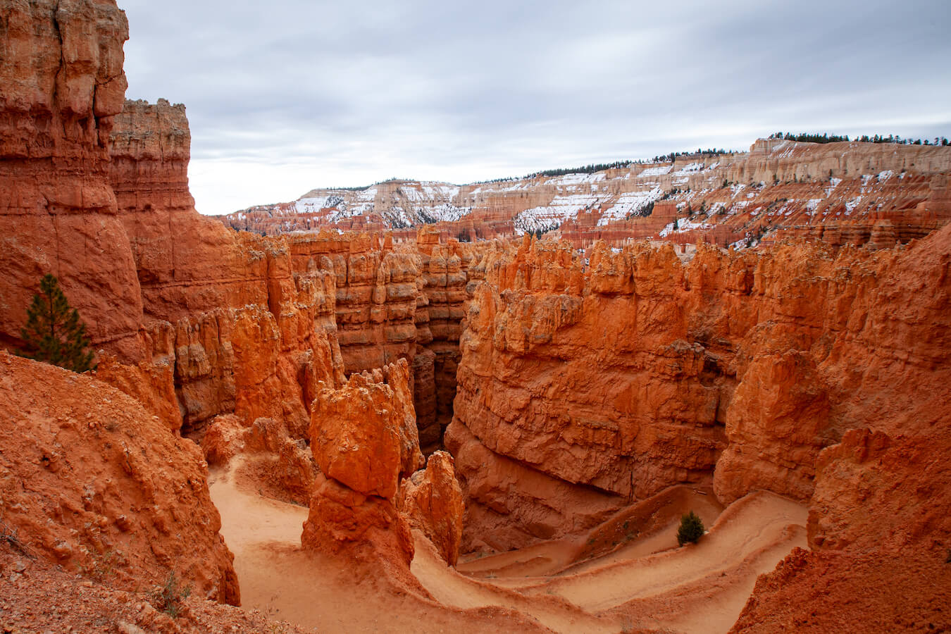
Second, the descent down into the canyon via the Queens Garden Trail was much prettier and gentler on our legs. According to the National Park Service, “The Queens Garden Trail beginning at Sunrise Point, descending 320 feet (98m), is considered the least difficult trail entering the canyon from the rim.“ Starting here allowed us to ease ourselves down the hiking trail and to enjoy our surroundings.
I’ve hiked this hike during different times of the year. In the winter, I wished I had had crampons on for my shoes because even though it was accessible, the snow pack was still pretty slippery. In the summer, I needed extra water and layers. It’s important to plan ahead and to be prepared for different conditions.
The Queen’s Garden Trail
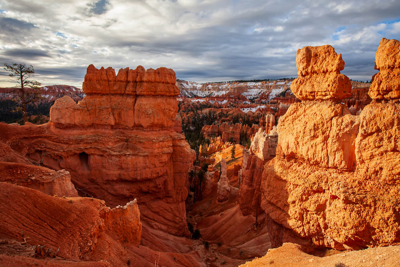
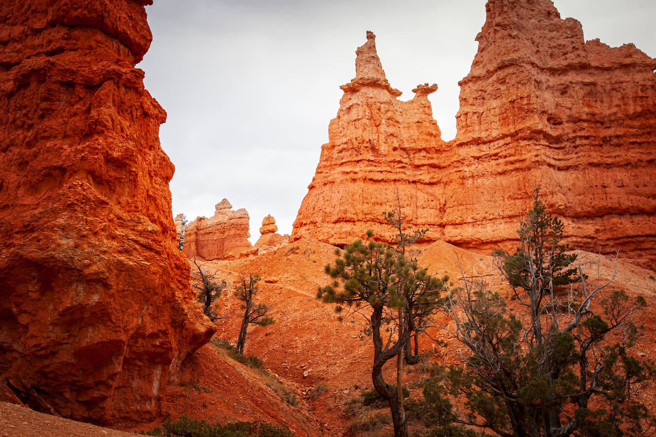
The Queens Garden Trail lasted for 1.8 mi on the Queen’s Garden/Navajo Combination Loop. At one point along the trail, we actually got to walk through a hoodoo! We also saw several tiny natural windows dotted along the desert landscape.
Walking amidst the hoodoos transports you. We felt like we were on an alien planet dotted with bits of ancient green trees and patches of white snow. Native American legend states that these ancient hoodoos were once their ancestors immortalized into stone. I can see why they believed that. We often thought we saw faces upon these unearthly rock formations.
After hiking for about an hour, we finally reached a fork in the trail.
Queens Garden
We deviated from the Queen’s Garden/Navajo Combination Loop Hike for a few hundred feet to see Queen’s Garden. Queen’s Garden was named after a rock formation that looked like Queen Victoria. Can you find her in the above photograph? I think it was worth deviating off of the path to see. In addition to seeing Queen Victoria, Queen’s Garden also contained one of the signs for the “Hike the Hoodoos” challenge. After drinking some water, taking photos, and eating snacks, we continued on down towards the Navajo Loop connecting trails.

The Navajo Loop
When we reached the Navajo Loop, we found another sign for the “Hike the Hoodoos” challenge. After we took our selfie, we then came to a crossroads. At the base of the Navajo Loop, where the Queens Garden Trail meets up with it, there are several options you can take. Either path will bring you up out of the hoodoos to Sunset Point. I personally recommend taking the fork on the Navajo Loop towards Wall Street. The path on the Navajo Loop towards Wall Street quickly changes from a forested fairyland to a steep incline of solid rock.
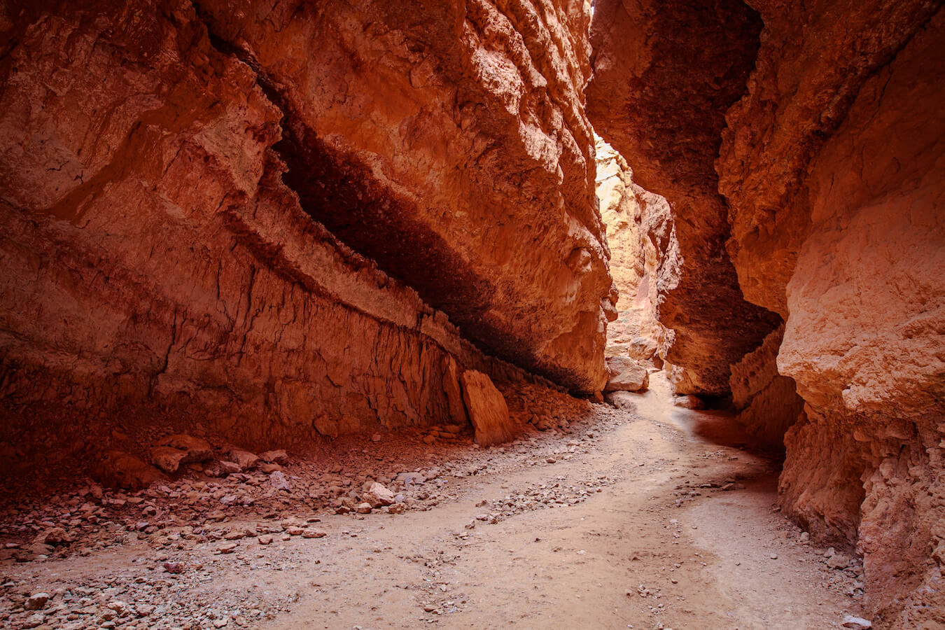
Wall Street on the Navajo Loop
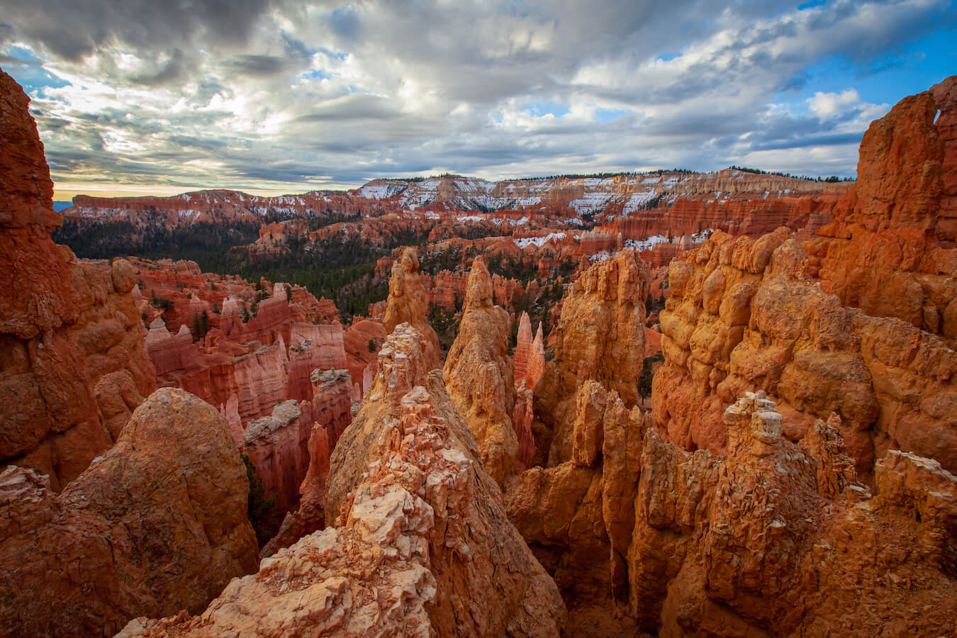
Entering Wall Street was spectacular!!! This is the last part of the Queen’s Garden/Navajo Combination Loop. Take your time hiking up this monstrosity. It is nothing but steep switchbacks, weaving in and out between the tall hoodoo towers. But, with some patience and a lot of effort, we finally emerged from Wall Street.
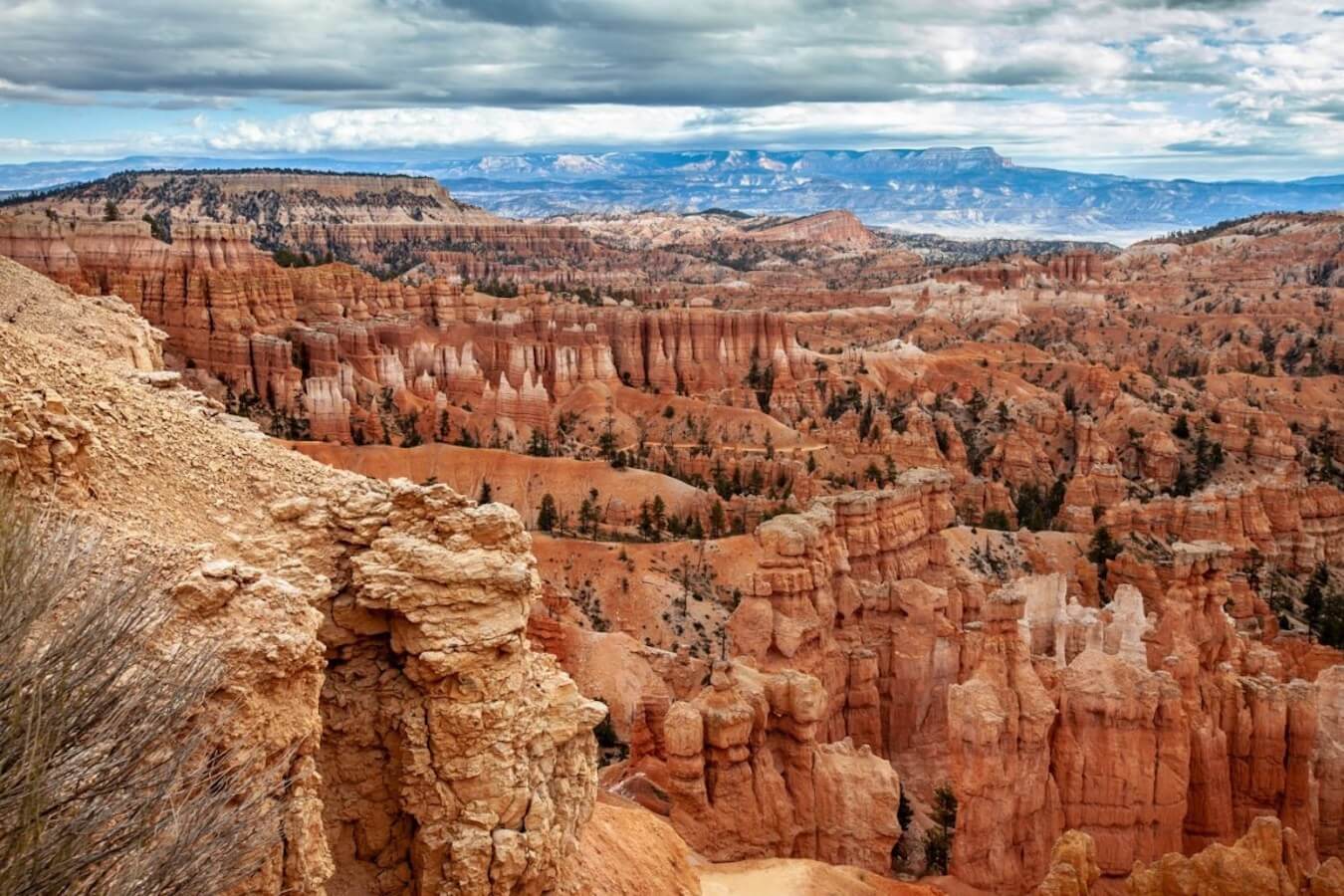
Sunset Point at Bryce Canyon National Park
Finally, we arrived at Sunset Point. All I can say is “WOW!!!” This vista point took my breath away. We had a gentle cloud cover for most of our hike, which provided magnificent lighting and drama for this photograph.
The final stretch of the Queens/Navajo Loop Combination Hike includes part of the Rim Trail. It was .5 miles from Sunset Point back to Sunrise Point, where our car was parked. If you are too tired to complete the loop (as my two little girls were), then you can send your strongest hikers on ahead and wait for them to come pick you up. Sunset point has parking, benches to rest on, as well as bathrooms and dumpsters.
Find Your Favorite Location
No matter where you stop, the Queen’s Garden/Navajo Combination Loop Trail provides amazing landscape photography opportunities. Be sure to take your time and find your favorite location along the way. If you are lucky, you may even spot some wildlife! Don’t forget to add detailed shots of the hoodoos, change your perspective, and most importantly enjoy your time in Bryce Canyon National Park.
Before making your trip, consider checking the official Bryce Canyon National Park website or contacting the park’s visitor center for the most up-to-date information on trail conditions, accessibility, and any recent changes. As with any visit to a national park, it’s important to follow park regulations, practice “Leave No Trace” principles, and prioritize safety while exploring this beautiful area. Enjoy your time exploring the natural wonders of the Queen’s Garden/Navajo Combination Loop!
Happy Travels!
Juventa, Co-Owner, National Park Photographer
Do you want more information about photographing Bryce Canyon National Park? Check out our new Photographer’s Guide to Bryce Canyon National Park!
Please note, by making purchases through our affiliate links, you are supporting our mission to celebrate and showcase our National Parks and the photographers who frequent them. As an Amazon Associate, National Park Photographer earns from qualifying purchases at not cost to you. We appreciate your support.