Length: .2 mi (.3 km)
Elevation Gain: 105 ft (32 m)
Route Type: Out and Back
Difficulty: Moderate
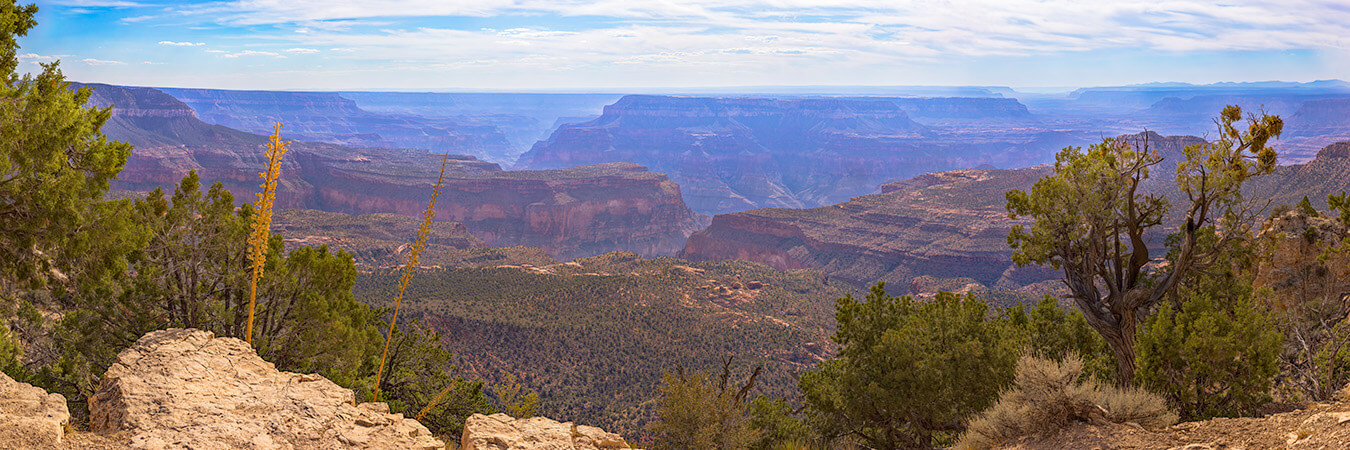
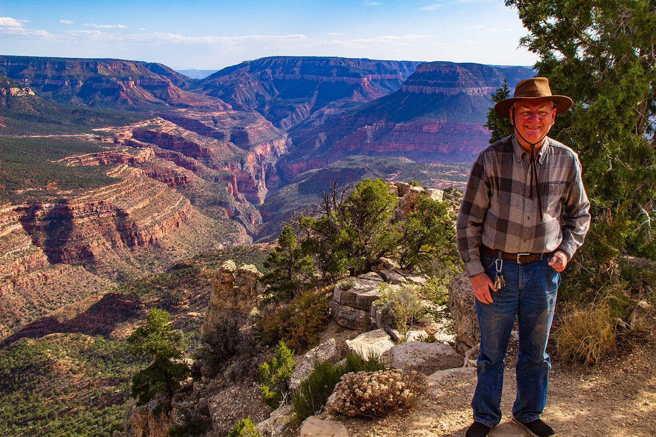
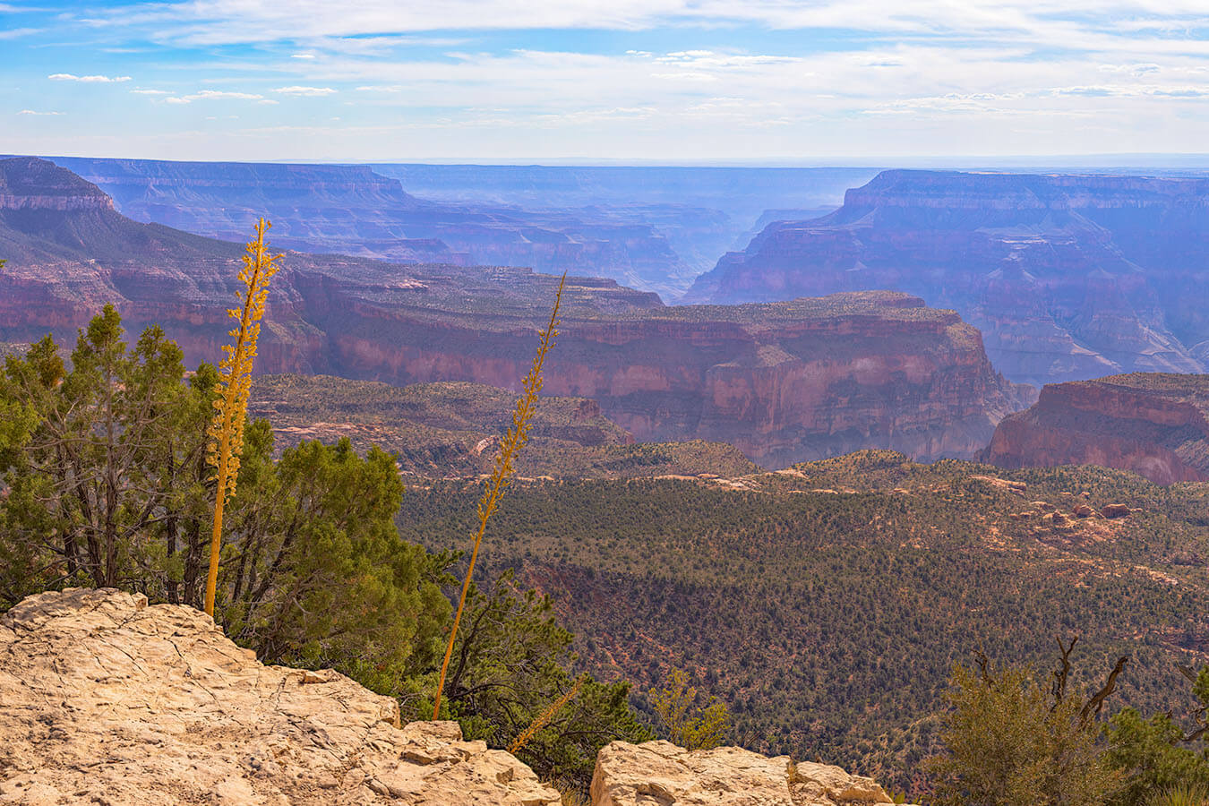
Crazy Jug Point, accessed through Kaibab National Forest, offers a stunning view of the North Rim of Grand Canyon National Park. From this viewpoint, you will look into the Tapeats Amphitheater in the Grand Canyon. “The spectacular canyonlands panorama includes Fishtail Mesa to the west, Steamboat Mountain, and Powell Plateau to the south.” (onxmaps)
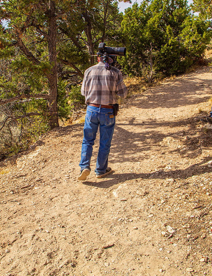
Starting at the south end of the Crazy Jug parking area, you will go through an opening in the wood rail fence and descend on a short sloped faint gravel trail, heading south toward the rim of the Grand Canyon. You will have to descend down a couple of steep descents before the trail levels out some. Some caution is advised as you make these descents as there are many loose rocks and tree roots to trip over. Angle slightly to the left as you near the end of the point and you will soon find the observation area.
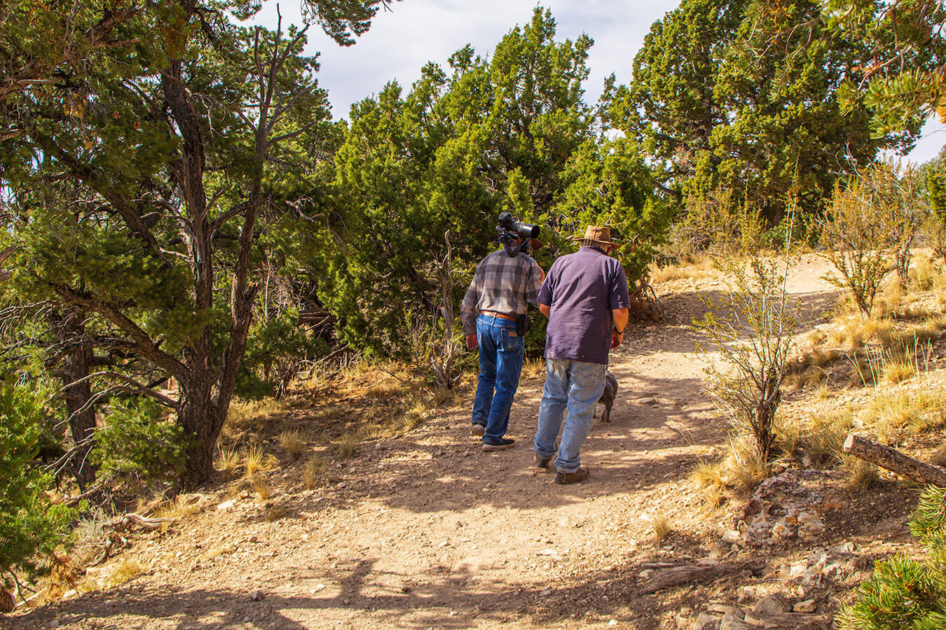
Accessing Crazy Jug Point
Starting Location: Parking lot at the end of National Forest road 292B, North Rim, AZ
GPS (DD): 36.426525, -112.403493
Crazy Jug Point is west of the developed North Rim area in the Kaibab National Forest. A high clearance 4×4 Jeep, SUV or pickup truck, is required. Reaching this free dispersed camping area is certainly not for the faint of heart! The narrow, rugged roads should only be attempted by experienced back country drivers. The access to this location is through Kaibab National Forest and not in the National Park. You only enter the National Park about .25 mi (.4 km) north of the parking lot. An accurate back country map and GPS with back country maps is highly recommended. Make sure you have your Bunny Trails on in your GPS to help you backtrack back out of the area.
We started at Jacobs Lake at the junction of US Highway 89A and State Highway 67. Crazy Jug Point is approximately 40 miles via the following route:
Head south on Rt. 67 about .25 mi (.4 km) and turn right (west) on National Forest Road 461. This road will proceed west for several miles and eventually descend down a steep hill where you will come to a junction where it joins with National Forest Road 230C and becomes National Forest Road 461/230C. You will take the right turn heading west another 2 to 3 miles (3.2-4.8 km).
Eventually you will come to a junction with National Forest Road 22. At this junction you will make a left turn onto National Forest Road 422. This road is also called West Side Road or Ryan Rd on the maps. Remain on this road for several miles to the junction with National Forest Road 425 at GPS coordinates 36.53575, -112.337772.
Turn right (west) onto Rd 425. Continue or Rd 425 several miles to junction with National Forest Road 292/272 at GPS coordinates 36.446427, -112.393546. Turn left onto Road 292/272 and follow it for about .25 mi (.4 km). At this point Road 292 forks to the right. Remain on Road 292 for approximately .5 mi (.8 km).
At this point (GPS 36.430426, -112.403639) you will come to a 4-way junction. Turn left onto Road 292B. Follow Road 292B for about 800 yards. You will see road 292C that intersects with 292B that forks to the left heading east. Do not take that road. Instead, turn right (south) at the fork of 292B and 292C. Continue of Road 292B for about another 400 yards. At this point you will arrive in the Crazy Jug parking area.
Travel Tips at Crazy Jug Point and the North Rim of the Grand Canyon
There are numerous viewpoints overlooking the North Rim of the Grand Canyon west of Highway 67. These are all accessed via the Kaibab National Forest access roads. These roads are generally closed in the winter months from late October to April. Only experienced back country travelers should attempt traveling these roads. Crazy Jug is a back country camping area with numerous tent sites. There is a 14 day camping limit. There are no facilities and there is limited cell service. Some sites have picnic tables. The overlook at the edge of the rim is fairly small and there are no benches to sit on.
Photography Tips at Crazy Jug Point
Ideally, this location should be photographed during the morning or evening Golden Hours. Sunsets would be especially nice during late May, June and early July because the sun sets further north and shines nicely along the length of the canyon. This is why I mentioned camping because I would not recommend traveling into or out of this location after dark. The Monsoon season in July could be good for nice storms and lightning shoots. However, the roads can be difficult if they get wet and muddy. Most people will likely want to use a wide angle lens 24mm or wider.
For my header image featured on this page, I used a Canon R5 camera body, Canon 100-400mm 5.6-8 IS USM RF lens @200mm, mounted on a Nodal Ninja M2 panoramic nodal head. My settings were f/13, 1/800th sec., and ISO 400. The original image consists of 1728 individual focus bracketed images. These were processed down to 110 focus stacked images, 5 rows x 22 columns, and then stitched into the 2.19 Gigapixel, 90 in. x 270 in. 300 dpi wall mural image. For information about purchasing my “Crazy Jug Point, South Eastern View” image, click here.
Closing Remarks
The receptionist at the Jacobs Lake RV park where we were camped clued me in on this location. She said she thought that Crazy Jug Point was one of the most scenic of all the locations along the entire north rim. I would have to agree that it is one of the nicer viewpoints on the North Rim.
Find Your Favorite Location
No matter where you go in Grand Canyon National Park, be sure to take your time and find your favorite location along the way. If you are lucky, you may even spot some wildlife! Don’t forget to add detailed macro shots, change your perspective, and most importantly have fun.
Before making your trip, consider checking the official Grand Canyon National Park website or contacting the park’s visitor center for the most up-to-date information on trail conditions, accessibility, and any recent changes. As with any visit to a national park, it’s important to follow park regulations, practice “Leave No Trace” principles, and prioritize safety while exploring this beautiful area. Enjoy your time exploring the natural wonders of Crazy Jug Point!
Happy Travels!
John Freeman, Featured National Park Photographer
Want to learn more about Grand Canyon National Park? Check out these maps, guides & books:
- Grand Canyon, North and South Rims [Grand Canyon National Park] (National Geographic Trails Illustrated Map)
- National Geographic Park Profiles: Grand Canyon Country: Over 100 Full-Color Photographs, plus Detailed Maps, and Firsthand Information
- Lonely Planet Grand Canyon National Park 6 (National Parks Guide)
- A Complete Guide to the Grand Circle National Parks: Covering Zion, Bryce Canyon, Capitol Reef, Arches, Canyonlands, Mesa Verde, and Grand Canyon National Parks (English and Japanese Edition)
- Grand Canyon National Park (Postcard History Series)
Please note, by making purchases through our affiliate links, you are supporting our mission to celebrate and showcase our National Parks and the photographers who frequent them. As an Amazon Associate, National Park Photographer earns from qualifying purchases at not cost to you. We appreciate your support.