Length: 30mi (48.28 km)
Driving Time: 1 hr 12 min
Route Type: Out and Back Drive
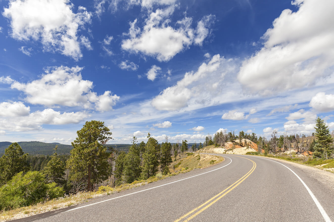
The Southern Scenic Drive in Bryce Canyon National Park takes you on top of the narrow wedge of the Paunsaugunt Plateau. Instead of endless seas of hoodoos, the southern section of Bryce Canyon is filled with steep cliffs, buttes, and sweeping panoramic vistas. This change in scenery provides amazing photography opportunities. I encourage you to take your time as you explore this beautiful section of the park. It is well worth visiting.
Due to the high elevation, the Southern Scenic Drive closes periodically over the winter months. Be sure to check the park website for current road conditions before you go. Also, please note that as the park shuttle does not go to any of the overlooks along the Southern Scenic Drive, you will need to drive to get there.
Accessing the Southern Scenic Drive
Starting Location: Intersection of UT-63 and Bryce Point Road
GPS (DD): 37.617755, -112.175750
The Southern Scenic Drive in Bryce Canyon National Park starts just past Bryce Point Road along the main park road, UT-63. While the main park road is a total of 18 miles long, the first three miles are considered the Bryce Amphitheater section of the park. The next 15 miles comprise the Southern Scenic Drive. You will want to plan on 2-3 hours if you are stopping at each of the main overlooks. If you plan on hiking the Bristlecone Loop Trail, then give yourself additional time.
The altitude here ranges from 7,000-9,100 ft (2,134-2,774 m) and is the highest section of Bryce Canyon National Park. As the main pullouts are along the Eastern side of the road, I recommend driving up to Rainbow Point first and then pulling out on your way back down. Going south to north will greatly simplify your ability to enter and park at each pullout.
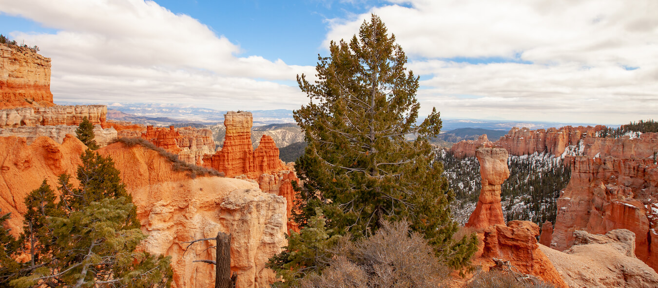
Viewpoints Along the Southern Scenic Drive
The Southern Scenic Drive has 9 main viewpoints. To help you visualize and navigate the Southern Scenic Drive better, I’ve created this photo guide for you. Here is a list, starting at Rainbow Point and ending at the Swamp Canyon Overlook, showing each of the scenic overlooks in order.
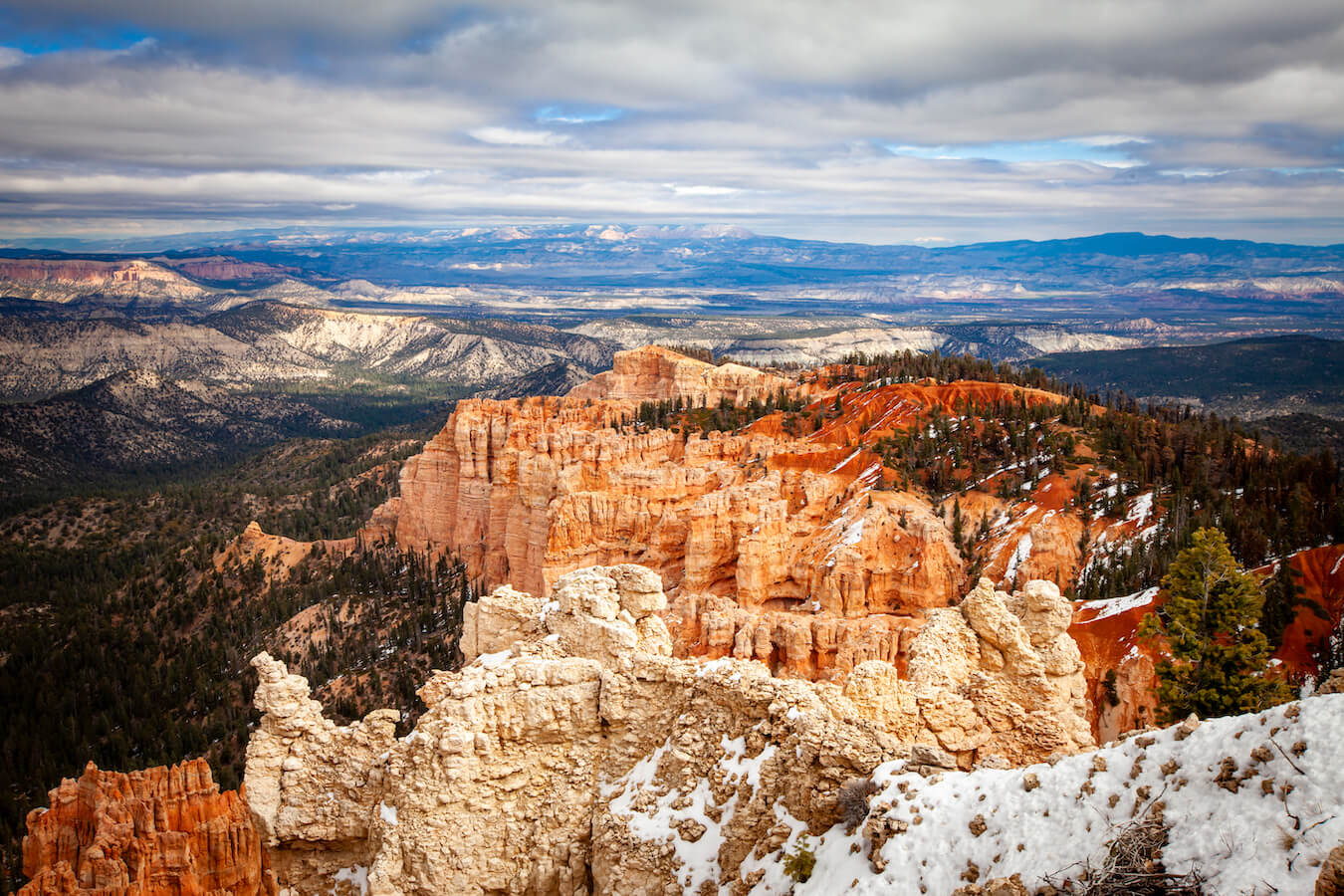
Rainbow Point Overlook
The Rainbow Point Overlook is located at the very end of the Southern Scenic Drive. The lookouts are right next to the parking lot. Rainbow Point has a long walkway, picnic area, and public restrooms. You can access Yovimpa Point, Riggs Spring Loop, Under-the-Rim, and Bristlecone Loop Trails from this overlook.
Yovimpa Point Overlook
The Yovimpa Point Overlook is accessible from the Rainbow Point parking lot and is one of the highest viewpoints in the park. This is a paved path with easy stroller and wheelchair access. From the sidewalk leading to Yovimpa Point, you can also access the Riggs Spring Loop Trail and Bristlecone Loop Trail. This overlook is spectacular and feels like you are on a ship looking out at sea.
Black Birch Canyon Overlook
The Black Birch Canyon Overlook is a beautiful in-and-out vista. It is located at mile 16.5 of the 18-mile Southern Scenic Drive. While there are technically no black birch trees here, I loved seeing the pine and fir trees as well as the natural window in the rock formation in the distance. There is no trail access from this overlook.

Ponderosa Canyon Overlook
The Ponderosa Canyon Overlook is located at mile 14.75 of the 18-mile Southern Scenic Drive. What I loved about this overlook was the contrast between the green trees, rainbow mountains, and red rock hoodoos. You can access the Agua Canyon Connecting Trailhead here (currently closed – click here for current conditions).

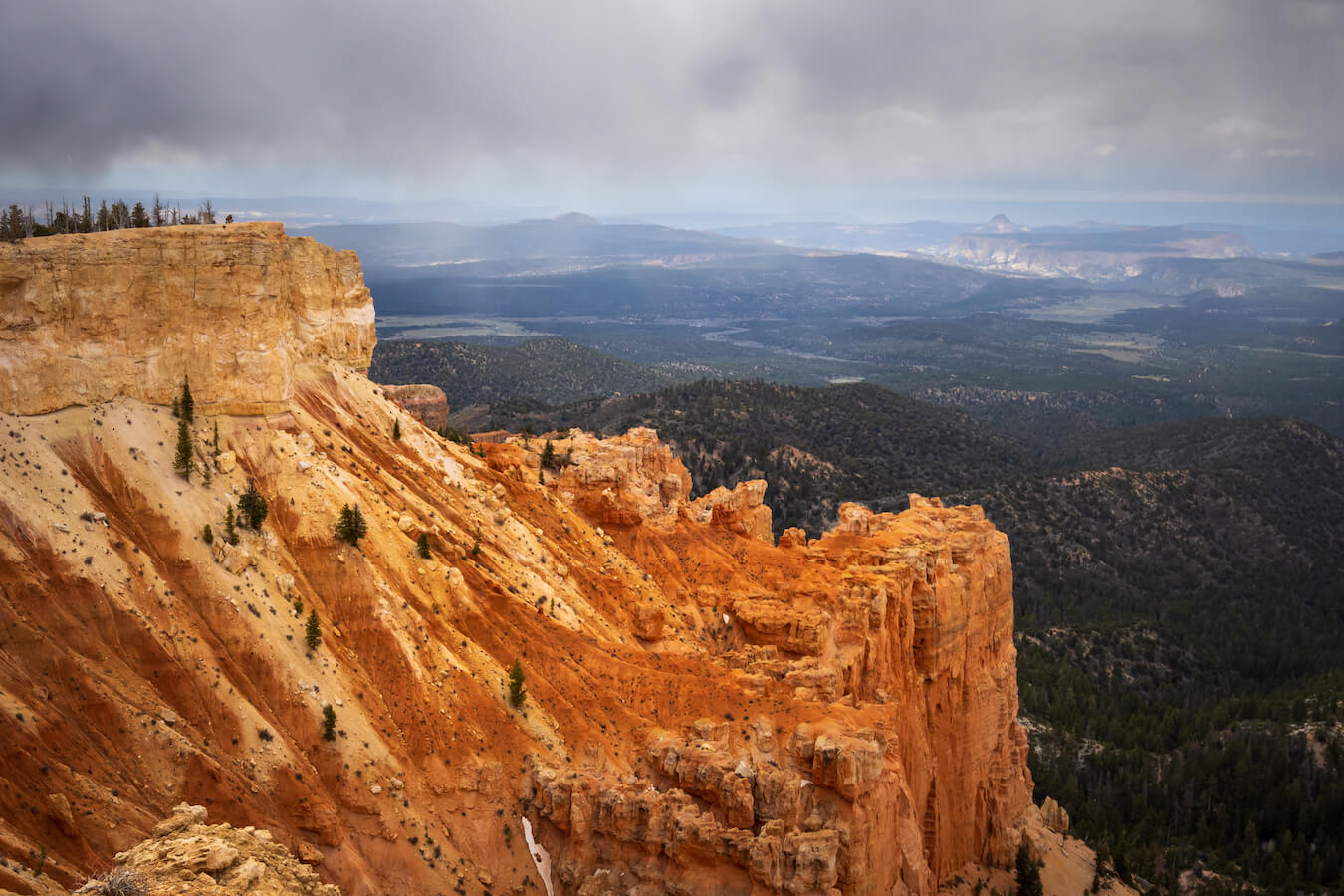
Agua Canyon Overlook
The Agua Canyon Overlook is stunning. I loved the diversity of trees, hoodoos, rock formations, and rolling hills. It is located at mile 13.5 of the 18-mile Southern Scenic Drive. Two prominent hoodoo formations here are the “Hunter” and the “Rabbit” or “Backpacker.” There is no trail access from this overlook.

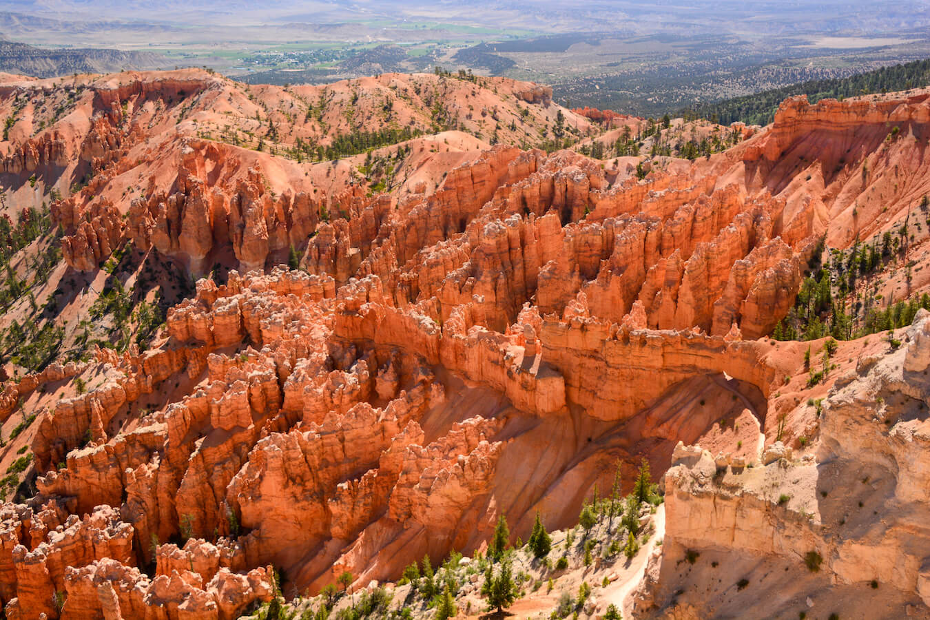
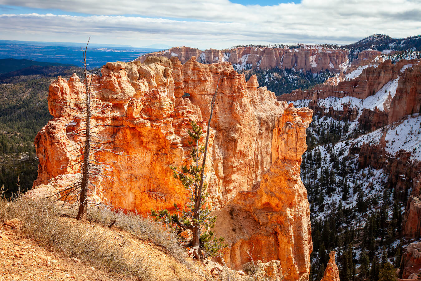
Natural Bridge Overlook
If you only look at one overlook on the Southern Scenic Drive, I suggest stopping at the Natural Bridge Overlook. It is located at mile 12.25 and is one of the most iconic overlooks in this section. Just a short distance from your car, you can look down and see this beautiful arch! Normally, you would have to hike miles to see something like this. There is no trail access from this overlook.

Farview Point Overlook
The Farview Point Overlook, located at mile 10.25 of the 18-mile Southern Scenic Drive, has access to two overlooks: Farview Point, which is right next to the pull-out, and Piracy Point, which is a small hike. This overlook offers a vista of the Table Cliff Plateau, Navajo Mountain, and the Henry Mountains. There is also a restroom here if needed.

Piracy Point Overlook
I fell in love with Piracy Point. You can access the short, flat, and unpaved trail from the Farview Point parking lot. While the trail was slightly icy and muddy when I went, the colors were magnificent and there was a lot of diversity. Piracy Point overlooks Sheep Creek and Swamp Canyon, offering a unique perspective.

Swamp Canyon Overlook
The Swamp Canyon Overlook is located at mile 6 of the 18-mile Southern Scenic Drive and is the last stop before returning to the Bryce Amphitheater. From here, you can access the 4 mi (6.4 km) moderately strenuous Swamp Canyon/Sheep Creek Loop Trail, which in turn provides access to the 23 mi (37 km) Under-the-Rim Trail. This hike counts towards the Hike the Hoodoos Challenge.
Pro Tip: If you are planning on using the park shuttle to see the Bryce Amphitheater section of the park, then you may want to consider visiting Paria View on your way out of Bryce Canyon. The shuttle does not stop at Paria View but it is worth a visit. It is located at the end of Bryce Point Road on the right.
Find Your Favorite Location along the Southern Scenic Drive
No matter where you stop, you will love the vistas found along the Southern Scenic Drive. Be sure to take your time and find your favorite location along the way. If you are lucky, you may even spot some wildlife! Don’t forget to add detailed shots of the hoodoos, change your perspective, and most importantly enjoy your time in Bryce Canyon National Park.
Before making your trip, consider checking the official Bryce Canyon National Park website or contacting the park’s visitor center for the most up-to-date information on trail conditions, accessibility, and any recent changes. As with any visit to a national park, it’s important to follow park regulations, practice “Leave No Trace” principles, and prioritize safety while exploring this beautiful area. Enjoy your time exploring the natural wonders of the Southern Scenic Drive!
Happy Travels!
Juventa, Co-Owner, National Park Photographer
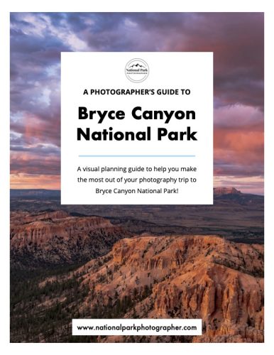
Do you want more information about photographing Bryce Canyon National Park? Check out our new Photographer’s Guide to Bryce Canyon National Park!
Please note, by making purchases through our affiliate links, you are supporting our mission to celebrate and showcase our National Parks and the photographers who frequent them. As an Amazon Associate, National Park Photographer earns from qualifying purchases at not cost to you. We appreciate your support.